Scientific Investigations Report 2007–5008
U.S. GEOLOGICAL SURVEY
Scientific Investigations Report 2007–5008
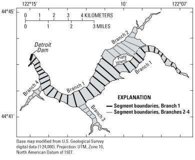
Figure 2. Location of segment boundaries for the Detroit Lake model grid. Branch 1, the main branch, extends from the North Santiam River inflow to the dam; the other branches join the main branch at the locations shown.

![]() U.S.
Department of the Interior | U.S. Geological
Survey
U.S.
Department of the Interior | U.S. Geological
Survey
Persistent URL: https://pubs.water.usgs.gov/sir20075008
Page Contact Information: Publications Team
Page Last Modified: Thursday, 01-Dec-2016 19:41:00 EST
