Scientific Investigations Report 2007–5050
U.S. GEOLOGICAL SURVEY
Scientific Investigations Report 2007–5050
Version 1.1, April 2010
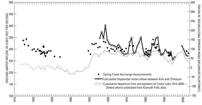
Figure 12. Discharge measurements of Spring Creek, estimated ground-water discharge to the lower Williamson River between Kirk and Chiloquin, and cumulative departure from average precipitation at Crater Lake, Oregon. (Spring Creek measurements from Hubbard and others, 1993, 1994; U.S. Geological Survey, various dates; and USGS and OWRD unpub. data; ground-water discharge estimated as the difference between the flow of the Williamson River below the Sprague River [gaging station 11502500] and the sum of flows of the Williamson River near Kirk [11493500] and the Sprague River near Chiloquin [11501000].)

![]() U.S.
Department of the Interior | U.S. Geological
Survey
U.S.
Department of the Interior | U.S. Geological
Survey
Persistent URL: https://pubs.water.usgs.gov/sir20075050
Page Contact Information: Publications Team
Page Last Modified: Thursday, 01-Dec-2016 19:41:50 EST
