Scientific Investigations Report 2007–5050
U.S. GEOLOGICAL SURVEY
Scientific Investigations Report 2007–5050
Version 1.1, April 2010
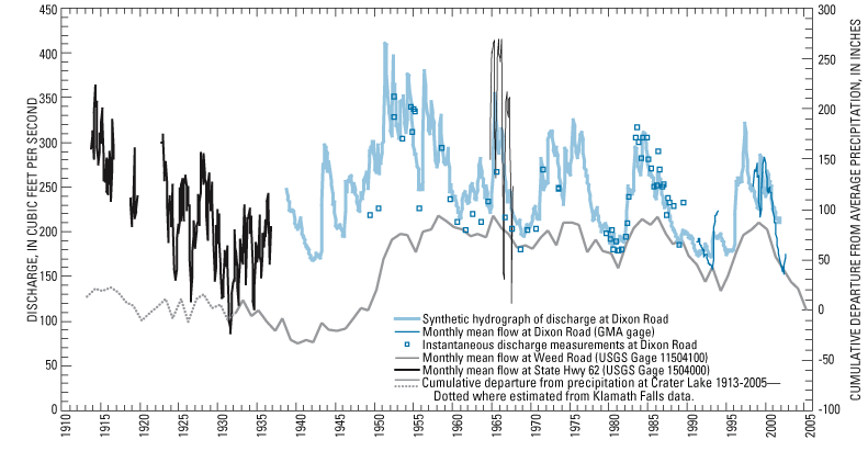
Figure 14. Discharge of the Wood River as measured or estimated at various sites, and the cumulative departure from average precipitation at Crater Lake, Oregon. (Monthly mean flow near headwaters from Graham Matthews, GMA, written commun. May 13, 2003; flow measurements near headwaters from USGS, various dates, and OWRD unpub. data; estimated discharge at Dixon road derived from regression with Fall River in upper Deschutes Basin [USGS gaging station 14057500], a similar size spring-fed stream.)

![]() U.S.
Department of the Interior | U.S. Geological
Survey
U.S.
Department of the Interior | U.S. Geological
Survey
Persistent URL: https://pubs.water.usgs.gov/sir20075050
Page Contact Information: Publications Team
Page Last Modified: Thursday, 01-Dec-2016 19:41:52 EST
