Scientific Investigations Report 2007-5070
Prepared in cooperation with
City of Tallahassee
 |
Select an option: |
|
CONTENTS Abstract Introduction Purpose and Scope Description of Study Area Approach Geologic and Hydrologic Framework Geologic Setting Lithologic Units and Description Depositional and Structural History Hydrologic Setting Ground-Water Flow System Long-Term Water-Level Trends Recharge to the Upper Floridan Aquifer and Porosity Development Ground-Water Chemistry and Age Dating Water Sample Collection and Analysis Tritium and Tritium/Tritiogenic Helium-3 Dating Method Chlorofluorocarbon and Sulfur Hexafluoride Dating Methods Chemistry Analysis Stable Isotopes Dissolved Gases Ground-Water Ages Ground-Water Flow Modeling Conversion of Original MODFLOW Model Model Recalibration Simulated and Measured Drawdowns for an Aquifer Test Ground-Water Age Dating and Effective Porosity Determination Delineation of Contributing Areas for City of Tallahassee Public-Supply Wells Overview of Contributing-Area Delineation Delineated Contributing Areas for All Wells Time-Dependent Capture Zones for Representative Wells Contributing Areas for All Wells Effect of Model Parameter Changes on Contributing-Area Delineation Cross Section of Probabilistic Contributing Areas Limitations of Contributing-Area Delineation Summary Selected References |
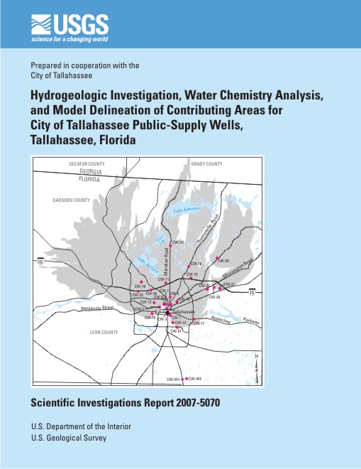
Ground water from the Upper Floridan aquifer is the sole source of water supply for Tallahassee, Florida, and the surrounding area. The City of Tallahassee (the City) currently operates 28 water-supply wells; 26 wells are distributed throughout the City and 2 are located in Woodville, Florida. Most of these wells yield an ample supply of potable water; however, water from several wells has low levels of tetrachloroethylene (PCE). The City removes the PCE from the water by passing it through granular-activated carbon units before distribution. To ensure that water-supply wells presently free of contamination remain clean, it is necessary to understand the ground-water flow system in sufficient detail to protect the contributing areas.
Ground-water samples collected from four public-supply wells were analyzed for tritium (3H), chlorofluorocarbons (CFCs), and sulfur hexafluoride (SF6). Using data for the CFC compounds, apparent ground-water ages ranged from 7 to 31 years. For SF6, the apparent ages tended to be about 5 to 10 years younger than those from CFCs. Apparent ages based on the tritium/tritiogenic helium-3 (3H/3Hetrit) method ranged from 26 to 33 years. The three dating methods indicate that the apparent age of ground water generally decreases from northern to southern Leon County. This southward trend of decreasing ages is consistent with increasing amounts of recharge that occur as ground water moves from north to south.
The ground-water age data derived by geochemical and tracer analyses were used in combination with the flow model and particle tracking to determine an effective porosity for the Hawthorn clays and Upper Floridan aquifer. The effective porosities for the Upper Floridan aquifer that resulted in best model matches were averaged to produce an effective porosity of 7 percent, and the effective porosities for the Hawthorn clays that resulted in a match were averaged to produce an effective porosity of 22 percent.
Probabilistic contributing areas were determined for 26 City wells using MODFLOW and MODPATH. For each probabilistic contributing area delineated, the model was run 100 times and the results were analyzed statistically. For each of the 100 runs, a different hydraulic conductivity for each of the zones was assigned to the Upper Floridan aquifer. The hydraulic conductivities were generated randomly assuming a lognormal probability distribution; the mean of the distribution was equal to the hydraulic conductivity from the calibrated model.
The 5-year time-dependent capture zones (TDCZs), assuming effective porosities of 0.1, 1, and 7 percent for four representative wells, were delineated. The higher probabilities of capture (greater than 40, 60, and 80 percent) were similar for all effective porosities, and the TDCZ delineated using a 7-percent porosity was slightly smaller; the lower probabilities of capture (greater than 10 and 20 percent) showed a large range of variability.
Davis, J.H., and Katz, B.G., 2007, Hydrogeologic Investigation, Water Chemistry Analysis, and Model Delineation of contributing Areas for City of Tallahassee Public-Supply Wells, Tallahassee, Florida: U.S. Geological Survey Scientific Investigations Report 2007-5070, 67 p.
U.S. Geological Survey
Florida Integrated Science Center
Suite 100
2010 Levy Avenue
Tallahassee, FL 32310
850-942-9500
| Accessibility FOIA Privacy Policies and Notices | U.S. Department of the Interior, U.S. Geological Survey
Persistent URL: https://pubs.usgs.gov/sir/2007/5070 Page Contact Information: USGS Publishing Network Page Last Modified: Thursday, 01-Dec-2016 19:47:55 EST |
 |