USGS - science for a changing world

Scientific Investigations Report 2007–5159

U.S. GEOLOGICAL SURVEY
Scientific Investigations Report 2007–5159
Back to Table of Contents

Figure - refer to figure caption for alternative text description

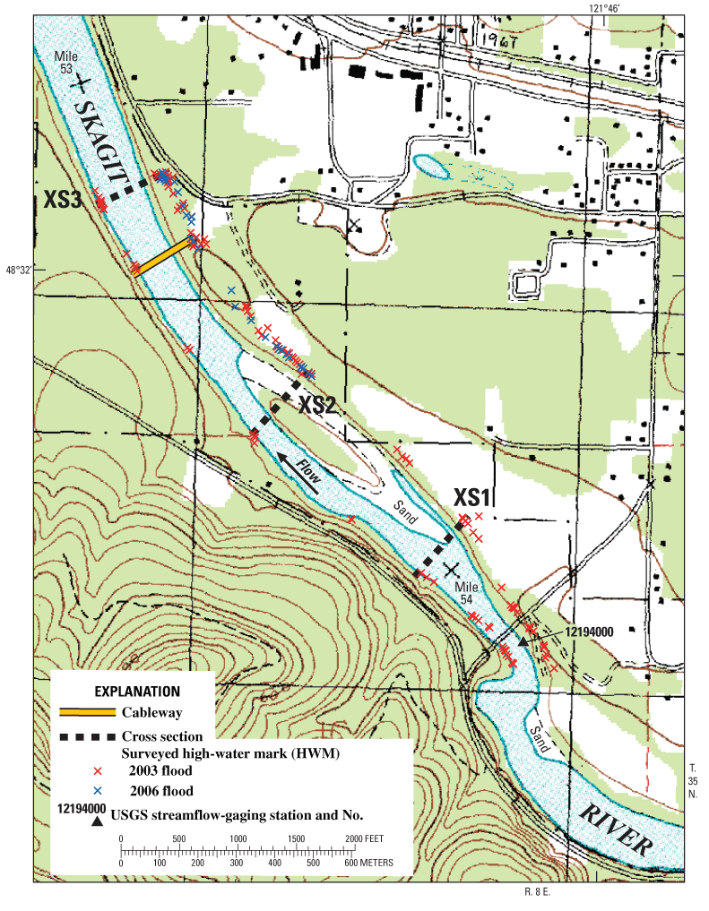
Figure 1. Topographic map of the slope-area measurement reach on the Skagit River near Concrete showing the three cross sections (XS1, XS2, and XS3), the streamflow-gaging station, and HWMs from the 2003 flood and the 2006 flood surveyed by the U.S. Geological Survey.

Back to Table of Contents

AccessibilityFOIAPrivacyPolicies and Notices

Take Pride in America logoUSA.gov logoU.S. Department of the Interior | U.S. Geological Survey
Persistent URL: https://pubs.water.usgs.gov/sir20075159
Page Contact Information: Publications Team
Page Last Modified: Thursday, 01-Dec-2016 19:47:48 EST