Arizona Water Science Center
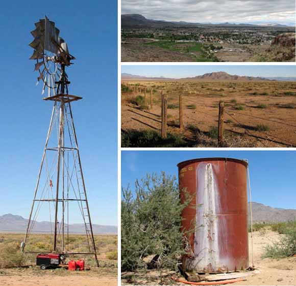
Clockwise from left: Windmill and well north of Long Mountain, Hualapai Valley (USGS photo by David W. Anning); view north across the City of Kingman, Hualapai Valley (USGS photo by Donald J. Bills); desert rangeland in southern Hualapai Valley with Long Mountain in the distance (USGS photo by David W. Anning); and water tank in Sacramento Valley (USGS photo by David W. Anning).
Ground-water levels for water year 2006 and their change over time in Detrital, Hualapai, and Sacramento Valley Basins of northwestern Arizona were investigated to improve the understanding of current and past ground-water conditions in these basins. The potentiometric surface for ground water in the Basin-Fill aquifer of each basin is generally parallel to topography. Consequently, ground-water movement is generally from the mountain front toward the basin center and then along the basin axis toward the Colorado River or Lake Mead. Observed water levels in Detrital, Hualapai, and Sacramento Valley Basins have fluctuated during the period of historic water-level records (1943 through 2006). In Detrital Valley Basin, water levels in monitored areas have either remained the same, or have steadily increased as much as 3.5 feet since the 1980s. Similar steady conditions or water-level rises were observed for much of the northern and central parts of Hualapai Valley Basin. During the period of historic record, steady water-level declines as large as 60 feet were found in wells penetrating the Basin-Fill aquifer in areas near Kingman, northwest of Hackberry, and northeast of Dolan Springs within the Hualapai Valley Basin. Within the Sacramento Valley Basin, during the period of historic record, water-level declines as large as 55 feet were observed in wells penetrating the Basin-Fill aquifer in the Kingman and Golden Valley areas; whereas small, steady rises were observed in Yucca and in the Dutch Flat area.
Download the text of this report as a 32-page PDF file (sir2007-5182_text.pdf; 2.5 MB)
There are four appendixes to this report; they are provided here as Excel (.xls), comma-separated value (.csv), tab-delimited ASCII (.txt), and PDF (.pdf) files.
Go to the Appendixes folder (appendixes folder; 2.1 MB total)
Map showing depth to water and water-level altitude in 2006 for selected wells, Detrital, Hualapai, and Sacramento Valley Basins, Mohave County, Arizona
Download Plate 1 as a ~24.2" x 35.3" PDF file (plate/sir2007-5182_plate.pdf; 5.2 MB)
For questions about the content of this report, contact Dave Anning
Suggested citation and version history
Download a free copy of the latest version of Adobe Reader.
|
Help |
PDF help |
Publications main page |
| Western Scientific Investigations Reports |
| Water Resources |
Arizona Water Science Center
|
This report is also available in print but without the appendixes nor plate from:
USGS Information Services, Box 25286,
Federal Center, Denver, CO 80225
telephone: 888 ASK-USGS; e-mail: infoservices@usgs.gov

![]() U.S. Department of the Interior | U.S. Geological Survey
U.S. Department of the Interior | U.S. Geological Survey
URL: https://pubs.usgs.gov/sir/2007/5182/
Page Contact Information: Michael Diggles
Page Last Modified: February 11, 2008