Scientific Investigations Report 2007–5216
U.S. GEOLOGICAL SURVEY
Scientific Investigations Report 2007–5216

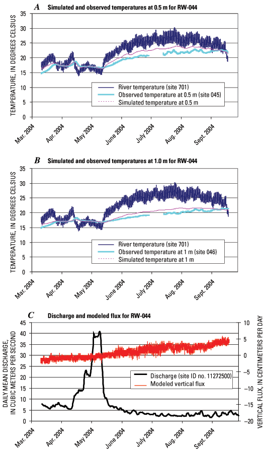
Figure 26. Plots of observed and simulated temperatures for monitoring well RW-044.
A. At 0.5 meters below the sediment–water interface. B. At 1 meter below the sediment–water interface. C. Resultant modeled vertical flux and stream discharge. The line breaks on the graphs represent missing data. The three digit site number in the Figure legend refers to the USGS site identification number with reference to figure 2 and table 1. (ID, identification; m, meter; no., number; RW, river well; USGS, U.S. Geological Survey.)