Scientific Investigations Report 2007–5251
U.S. GEOLOGICAL SURVEY
Scientific Investigations Report 2007–5251
Version 2.0, June 2013
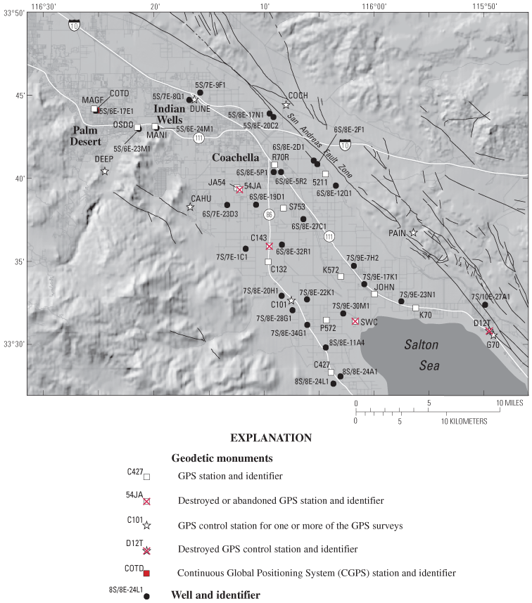
Figure 3. Map showing network of Global Positioning System (GPS) stations and wells used to monitor vertical changes in land surface and ground-water levels, respectively, in the southern Coachella Valley, California.

![]() U.S. Department of the Interior | U.S. Geological Survey
U.S. Department of the Interior | U.S. Geological Survey
URL: https://pubs.usgs.gov/sir/2007/5251
Page Contact Information: Publications Team
Page Last Modified: Thursday, 01-Dec-2016 19:55:58 EST
