Scientific Investigations Report 2007–5251
U.S. GEOLOGICAL SURVEY
Scientific Investigations Report 2007–5251
Version 2.0, June 2013

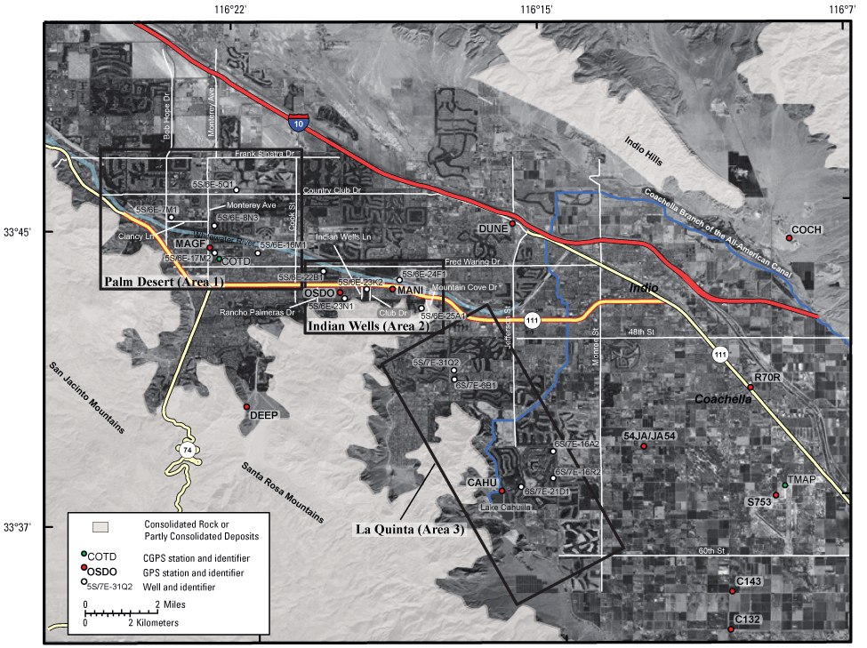
Figure 5. Image showing land-surface features, consolidated rock, Global Positioning System (GPS) stations, two Continuous Global Positioning System (CGPS) stations, three areas of subsidence, and selected roads and production wells, Coachella Valley, California. (Hydrographs for production wells are shown in figure 9.)