Scientific Investigations Report 2007–5251
U.S. GEOLOGICAL SURVEY
Scientific Investigations Report 2007–5251
Version 2.0, June 2013


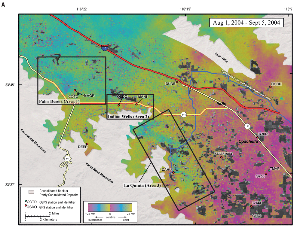
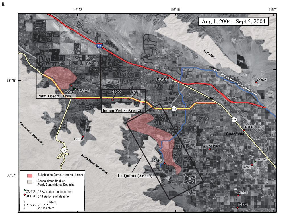
Figure 7. Areas of subsidence, consolidated rock, GPS stations, and two CGPS stations in the Coachella Valley, California, for August 1, 2004, through September 5, 2004, (A) as shown on the interferogram, and (B) as shown by subsidence contours interpreted from the interferogram in A.