Geographic Analysis and Monitoring Program
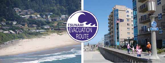
The cities of Manzanita (left) and Seaside (right) on the Oregon coast, shown with the internationally adopted tsunami-evacuation sign (Intergovernmental Oceanographic Commission, 2003). (USGS photographs by Nathan Wood.)
Evidence of past events and modeling of potential future events suggest that tsunamis are significant threats to Oregon coastal communities. Although a potential tsunami-inundation zone from a Cascadia Subduction Zone earthquake has been delineated, what is in this area and how communities have chosen to develop within it have not been documented. A vulnerability assessment using geographic-information-system tools was conducted to describe tsunami-prone landscapes on the Oregon coast and to document city variations in developed land, human populations, economic assets, and critical facilities relative to the tsunami-inundation zone. Results indicate that the Oregon tsunami-inundation zone contains approximately 22,201 residents (four percent of the total population in the seven coastal counties), 14,857 employees (six percent of the total labor force), and 53,714 day-use visitors on average every day to coastal Oregon State Parks within the tsunami-inundation zone. The tsunami-inundation zone also contains 1,829 businesses that generate approximately $1.9 billion in annual sales volume (seven and five percent of study-area totals, respectively) and tax parcels with a combined total value of $8.2 billion (12 percent of the study-area total). Although occupancy values are not known for each facility, the tsunami-inundation zone also contains numerous dependent-population facilities (for example, adult-residential-care facilities, child-day-care facilities, and schools), public venues (for example, religious organizations and libraries), and critical facilities (for example, police stations). Racial diversity of residents in the tsunami-inundation zone is low, with 96 percent identifying themselves as White, either alone or in combination with one or more race. Twenty-two percent of the residents in the tsunami-inundation zone are over 65 years in age, 36 percent of the residents live on unincorporated county lands, and 37 percent of the households are renter occupied. The employee population in the tsunami-inundation zone is largely in accommodation and food services, retail trade, manufacturing, and arts and entertainment sectors.
Results indicate that vulnerability, described here by exposure (the amount of assets in tsunami-prone areas) and sensitivity (the relative percentage of assets in tsunami-prone areas) varies considerably among 26 incorporated cities in Oregon. City exposure and sensitivity to tsunami hazards is highest in the northern portion of the coast. The City of Seaside in Clatsop County has the highest exposure, the highest sensitivity, and the highest combined relative exposure and sensitivity to tsunamis. Results also indicate that the amount of city assets in tsunami-prone areas is weakly related to the amount of a community's land in this zone; the percentage of a city's assets, however, is strongly related to the percentage of its land that is in the tsunami-prone areas. This report will further the dialogue on societal risk to tsunami hazards in Oregon and help identify future preparedness, mitigation, response, and recovery planning needs within coastal cities and economic sectors of the state of Oregon
Download this report as a 43-page PDF file (sir2007-5283.pdf; 2.3 MB)
Download the supporting database as an Excel .xls file. This database contains city-specific data on exposure and sensitivity to tsunami hazards and is described in Appendix B of the report (sir2007-5283.xls; 184 kB).
For questions about the content of this report, contact Nathan Wood.
Suggested citation and version history
Download a free copy of the latest version of Adobe Reader.
|
Help |
PDF help |
Publications main page |
| Western Scientific Investigations Reports |
| Geography | Geographic Analysis and Monitoring Program
|

![]() U.S. Department of the Interior | U.S. Geological Survey
U.S. Department of the Interior | U.S. Geological Survey
URL: https://pubs.usgs.gov/sir/2007/5283/
Page Contact Information: Michael Diggles
Page Last Modified: January 11, 2008