Scientific Investigations Report 2008–5044
U.S. GEOLOGICAL SURVEY
Scientific Investigations Report 2008–5044

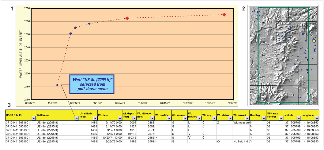
Figure 5. Example from appendix 1 Excel workbook showing water levels that were analyzed in well “UE-8e (2295 ft)”, Nevada Test Site, Nye County, Nevada. After a well is selected from pulldown menu, the worksheet is populated with (1) a hydrograph of all water-level measurements for the selected well—measurements used in contouring are shown as red diamonds; (2) a map showing the selected well location as a yellow circle; and (3) a table of water-level data for the selected well.