Scientific Investigations Report 2008-5047
Prepared in cooperation with the
Federal Emergency Management Agency
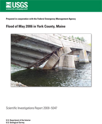
A stalled low-pressure system over coastal New England on Mother’s Day weekend, May 13–15, 2006, released rainfall in excess of 15 inches. This flood (sometimes referred to as the “Mother’s Day flood”) caused widespread damage to homes, businesses, roads, and structures in southern Maine. The damage to public property in York County was estimated to be $7.5 million. As a result of these damages, a presidential disaster declaration was enacted on May 25, 2006, for York County, Maine. Peak-flow recurrence intervals for eight of the nine streams studied were calculated to be greater than 500 years. The peak-flow recurrence interval of the remaining stream was calculated to be between a 100-year and a 500-year interval.
This report provides a detailed description of the May 2006 flood in York County, Maine. Information is presented on peak streamflows and peak-flow recurrence intervals on nine streams, peak water-surface elevations for 80 high-water marks at 25 sites, hydrologic conditions before and after the flood, comparisons with published Flood Insurance Studies, and places the May 2006 flood in context with historical floods in York County.
At sites on several streams, differences were observed between peak flows published in the Flood Insurance Studies and those calculated for this study. The differences in the peak flows from the published Flood Insurance Studies and the flows calculated for this report are within an acceptable range for flows calculated at ungaged locations, with the exception
of those for the Great Works River and Merriland River. For sites on the Mousam River, Blacksmith Brook, Ogunquit River, and Cape Neddick River, water-surface elevations from Flood Insurance Studies differed with documented water-surface elevations from the 2006 flood.
Stewart, G.J., and Kempf, J.P., 2008, Flood of May 2006 in York County, Maine: U.S. Geological Survey Scientific Investigations Report 2008–5047, 17 p., 1 pl. (online only).
For further information, contact:
Director
U.S. Geological Survey,
Maine Water Science Center
196 Whitten Road
Augusta, Maine 04330
This report is available PDF
Format (1.17 MB)
Plate 1 - PDF Format (3.68 MB)
If you have Adobe® Acrobat® or Adobe ® Acrobat® Reader® installed on your computer, you may view and print the PDF version of this report. Acrobat Reader, is a free download from Adobe Systems, Inc. Users with disabilities can view information concerning accessibility at access.Adobe.com.

![]() U.S. Department of the Interior |
U.S. Geological Survey
U.S. Department of the Interior |
U.S. Geological Survey
URL: http://pubs.usgs.gov/sir/2008/5047/
Page Contact Information: Publishing Service Center
Page Last Modified: Thursday, 10-Jan-2013 15:24:31 EST
