Scientific Investigations Report 2008–5071
U.S. GEOLOGICAL SURVEY
Scientific Investigations Report 2008–5071
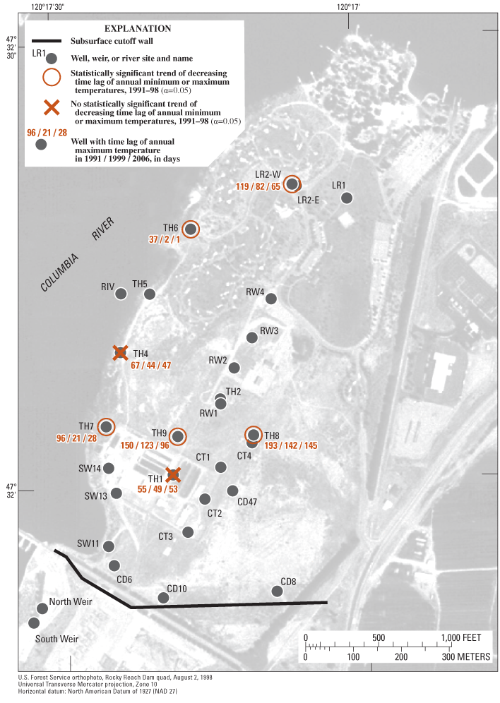
Figure 22. Spatial distribution of trends in time lags between annual minimum and maximum temperatures measured in the Columbia River at probe RIV and in wells of the monitoring system of the Eastbank Aquifer system with probes in the Lower or Combined Aquifers, 1991–98, and time lags between annual maximum temperatures in the river and wells in 1991, 1999, and 2006, Douglas County, Washington.

![]() U.S. Department of the Interior | U.S. Geological Survey
U.S. Department of the Interior | U.S. Geological Survey
URL: http://pubs.usgs.gov/sir/2008/5071
Page Contact Information: Publications Team
Page Last Modified: Thursday, 10-Jan-2013 18:46:17 EST
