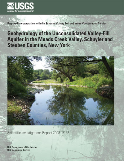
Scientific Investigations Report 2008–5122

This report is available online only in PDF Format (6.55 MB)
The Meads Creek valley encompasses 70 square miles of predominantly forested uplands in the upper Susquehanna River drainage basin. The valley, which was listed as a Priority Waterbody by the New York State Department of Environmental Conservation in 2004, is prone to periodic flooding, mostly in its downstream end, where development is occurring most rapidly.
Hydraulic characteristics of the unconsolidated valley-fill aquifer were evaluated, and seepage rates in losing and gaining tributaries were calculated or estimated, in an effort to delineate the aquifer geometry and identify the factors that contribute to flooding. Results indicated that (1) Meads Creek gained about 61 cubic feet of flow per second (about 6.0 cubic feet per second per mile of stream channel) from ground-water discharge and inflow from tributaries in its 10.2-mile reach between the northernmost and southernmost measurement sites; (2) major tributaries in the northern part of the valley are not significant sources of recharge to the aquifer; and (3) major tributaries in the central and southern part of the valley provide recharge to the aquifer. The ground-water portion of streamflow in Meads Creek (excluding tributary inflow) was 11.3 cubic feet per second (ft3/s) in the central part of the valley and 17.2 ft3/s in the southern part—a total of 28.5 ft3/s.
Ground-water levels were measured in 29 wells finished in unconfined deposits for construction of a potentiometric-surface map to depict directions of ground-water flow within the valley. In general, ground water flows from the edges of the valley toward Meads Creek and ultimately discharges to it. The horizontal hydraulic gradient for the entire 12-mile-long aquifer averages about 30 feet per mile, whereas the gradient in the southern fourth of the valley averages about half that—about 17 feet per mile.
A water budget for the aquifer indicated that 28 percent of recharge was derived from precipitation that falls on the aquifer, 32 percent was from losing reaches of tributaries, 38 percent was unchanneled flow from hillsides that slope toward the valley (this estimate includes runoff and shallow ground-water inflow from till and bedrock), and the remaining 2 percent was from deep ground-water inflow from till and bedrock to the sides and bottom of the aquifer. Nearly all (94 percent) of the water discharged from the aquifer is equivalent to the streamflow gain in Meads Creek; the remaining 6 percent discharges as deep outflow to unconsolidated deposits in the Cohocton River valley.
Several characteristics of the Meads Creek valley may contribute to flooding in the downstream area: (1) the southward decrease in the ground-water gradient impedes the ability of the aquifer to transmit water southward and can cause water levels to rise, (2) a high water table, typically only 5 to 10 feet below land surface, results in little storage capacity to absorb water from large storms, (3) a downstream narrowing of the valley impedes the southward flow of ground water and can cause water levels to rapidly rise during periods of prolonged or heavy precipitation, and (4) the upland slopes (till-covered bedrock) produce rapid runoff that recharges the aquifer. The combined effect of these conditions limits the ability of the aquifer to transmit sudden, large increases in recharge from precipitation and thereby provides a high potential for flooding in the southern third of the valley.
Abstract
Introduction
Study Area
Purpose and Scope
Methods
Streamflow Measurements
Well Inventory and Ground-Water-Level Measurements
Seismic-Refraction Surveys
Geology
Bedrock
Surficial Deposits
Hydrology
Aquifer Framework
Sources of Recharge
Recharge from Precipitation on the Aquifer
Recharge from Upland Sources
Recharge from Deep Ground-Water Inflow
Ground-Water Discharge and Direction of Movement
Gaining Streams
Ground-Water Underflow
Ground-Water Levels and Ground-Water Movement
Water Budget
Summary and Conclusions
Acknowledgments
References Cited
3–5. Maps showing—
| 3. | Locations of wells in which water levels were measured on June 1, 2, and 5, 2007, in Meads Creek valley, Schuyler and Steuben Counties, N.Y. |
| 4. | Bedrock geology of the Meads Creek basin, Schuyler and Steuben Counties, N.Y. |
| 5. | Surficial geology of the Meads Creek basin, Schuyler and Steuben Counties, N.Y. |
6–7. Diagrams showing—
| 6. | A) Vertical section A–A’ across Chambers Road near northern end of Meads Creek valley in the town of Orange, Schuyler County, N.Y., and map showing details of seismic-survey line, and (B) Vertical section B–B’ in the town of Campbell, near southern end of Meads Creek valley in Steuben County, N.Y., and map showing details of seismic-survey line. |
| 7. | Sources of recharge to, and discharge from, valley-fill aquifers in the glaciated Northeast. |
8–10. Maps showing—
| 8. | Discharge measurements for identification of gaining and losing reaches along Meads Creek and seven tributaries, Schuyler and Steuben Counties, N.Y., April 27, 2006. |
| 9. | Areas of unchanneled hillsides adjacent to the valley-fill aquifer that contribute recharge directly to the aquifer in the Meads Creek valley, Schuyler and Steuben Counties, N.Y. |
| 10. | Potentiometric surface in the Meads Creek valley-fill aquifer, June 1–5, 2007, Schuyler and Steuben Counties, N.Y. |
If you have Adobe® Acrobat® or Adobe® Acrobat® Reader® installed on your computer, you may view and print the PDF version of this report. Acrobat Reader, is a free download from Adobe Systems, Inc. Users with disabilities can view information concerning accessibility at access.Adobe.com.
Suggested citation: Miller, T.S., Bugliosi, E.F., and Reddy, J.E., 2008, Geohydrology of the unconsolidated valley-fill aquifer in the Meads Creek valley, Schuyler and Steuben Counties, New York: U.S. Geological Survey Scientific Investigations Report 2008–5122, 32 p, online only.
For more information please contact:
Director
U.S. Geological Survey
New York Water Science Center
425 Jordan Road
Troy, NY 12180
(518)285-5600
or visit our Web site at: http://ny.water.usgs.gov