U.S. Geological Survey Scientific Investigations Report 2008-5125
Abstract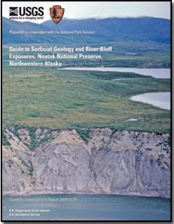
From its origin in rugged granitic highlands of the central Brooks Range, the Noatak River flows westward between the De Long Mountains and the Baird Mountains before turning south to enter Kotzebue Sound. Glaciers of middle and late Pleistocene age entered the Noatak River valley from the east, north, and south. Glaciers flowed down the upper Noatak River valley from the rugged peaks at its head, merging with tributary glaciers that issued from cirque-headed valleys along its south flank. Farther downvalley, small glaciers flowed northward from the Baird Mountains and much larger glaciers issued from the De Long Mountains. The De Long Mountains glaciers expanded southward to cover parts of the Noatak valley floor; they dammed the Noatak River during successive advances, creating a series of glacial lakes. The more extensive glacial advances dammed huge lakes that filled the Aniuk Lowland to overflowing. At various times, overflow waters spilled northward through Howard Pass, southward via Hunt River into the Kobuk River system, and westward down a series of channelways that skirted south of the glacier margins. Prominent bluffs along the Noatak River and its principal tributaries reveal glacial, glaciolacustrine, fluvial, and eolian sediments. More than 120 measured bluff exposures are described and illustrated in this report. These are dated by 92 radiocarbon age determinations and by the presence of the old Crow tephra, which was deposited about 130,000-140,000 years ago. Six geologic base maps, which cover sections of the Noatak River valley from east to west, show the locations of the river bluffs in relation to the glacial, glaciolacustrine, and fluvial deposits that cover the valley floor. The upper Noatak River valley is dominated by a bulky end moraine near Douglas Creek that was deposited during the last glacial maximum about 25,000-15,000 14C yr BP (termed the Itkillik II phase in the central Brooks Range glacial succession). Bluffs along this section of the Noatak River reveal thick till that underlies the moraine and interfingers downvalley with outwash and upvalley with moraine-dammed lake deposits. Remnants of older river gravels that underlie the set of glacial deposits contain wood fragments that are dated at about 35,000-30,000 14C yr BP. The Aniuk River area, which includes much of the eastern Aniuk Lowland, contains older moraines derived from headwaters of the Noatak valley that lie downvalley from the Douglas Creek moraine. These older moraines are assigned to the Itkillik IA and IB advances of the central Brooks Range glacial succession. Their deposits are seldom visible in river bluffs, but associated outwash and glaciolacustrine sediments are commonly exposed. More ancient end moraines farther downvalley are buried beneath lake deposits of the Aniuk Lowland, but are traceable as subdued arcuate drainage divides and as boulder concentrations in river bluffs or along their bases. The Cutler River area was occupied by glacial lakes assignable to three separate glacial phases. The oldest of these was probably dammed by the Cutler moraine, which crosses the Noatak valley floor near the mouth of Cutler River. The younger two are correlated with Itkillik-age deposits in the Aniuk Lowland. Glaciers of Itkillik age also flowed northwestward down the Cutler and Imelyak valley systems from cirques along the Noatak-Kobuk divide, but they did not reach the Noatak valley floor. The western Aniuk Lowland, which extends westward from the Cutler River mouth to the lower course of Nimiuktuk River, is dominated by a series of large end moraines deposited by glaciers from the De Long Mountains and that flowed southeastward down the Nimiuktuk valley system and then up the Noatak River valley. The Cutler moraine is the most extensive of these deposits. Following the Cutler glaciation, less extensive glacial advances built end moraines near the present-day mouths of Makpik Creek and Anisak River during intervals that may correlate with the Itkillik 1A and Itkillik 1B phases in the central Brooks Range. The Cutler, Makpik, and Anisak glaciers dammed the Noatak River, creating the series of glacial lakes that covered the Aniuk Lowland. High river bluffs through this sector of the Noatak valley expose sequences of massive till and glaciallake deposits that alternate with interglacial river gravels and organic-rich floodplain deposits. Floodplain sediments in two of the bluffs contain the Old Crow tephra, a stratigraphic marker for an early phase of the last interglaciation. Downvalley from Nimiuktuk River, glaciers in the De Long Mountains flowed southward through the Kalaktavik, Kugururok, and Kelly drainage systems, deflecting the Noatak River into a more southerly position against the north flank of the Baird Mountains. These glaciers dammed the Noatak drainage near the mouths of their valleys, and glacial lakes subsequently expanded northward up each valley when the glaciers receded. Ice advances of the last glacial maximum (locally termed the Avan glaciation) reached the mouth of Avan River valley, but elsewhere they were restricted to upper valleys and valley heads in the De Long Mountains and to cirques in the Baird Mountains. The reduced extent of these glaciers contrasts strongly with the much larger correlative glaciers of Itkillik II age throughout the central Brooks Range. Bluffs along the Noatak River and lower courses of its tributaries expose till and glaciolacustrine deposits, as well as terraced river gravels and floodplain deposits that formed during postglacial downcutting. In several locations, the postglacial alluvium contains wood or peat that yield radiocarbon ages of 13,000 yr BP and younger. The sparse river-cut exposures downvalley from Kelly River exhibit mainly lake deposits, associated deltas and fan deltas, and loess. Heavy loess cover obscures much of the older terrain across this sector of the Noatak valley floor. No significant exposures were recorded downvalley from the large fan-delta deposit of Eli River, possibly because the Noatak River has been aggrading through this section of its valley during Holocene time. |
First posted May 7, 2009
This report is also available in print from:
USGS Information Services, Box 25286, For additional information contact: This report is presented in Portable Document Format (PDF); at least version 7 of Adobe Reader or similar software is required to view it. Download the latest version of Adobe Reader, free of charge. |
Hamilton, T.D., 2009, Guide to surficial geology and river-bluff exposures, Noatak National Preserve, northwestern Alaska: U.S. Geological Survey Scientific Investigations Report 2008-5125, 116 p. [http://pubs.usgs.gov/sir/2008/5125/].
Abstract
Introduction
Upper Noatak River Valley
Aniuk River Area
Cutler River Area
Aniuk Lowland Below Cutler River—Noatak River Bluffs
Aniuk Lowland Below Cutler River—Tributary Drainages
Nimiuktuk River to Aklumayuak Creek
Sapun Creek
Sapun Creek to Kaluktavik River
Lower Kaluktavik River Valley
Kaluktavik River to Noatak Canyon
Noatak Canyon to Kugururok River
Kugururok River Valley
Kugururok River to Eli River
Kelly-Avan Drainage System
Eli-Uvgoon Drainage System
Summary and Regional Relations
Acknowledgments
References Cited
Appendixes 1-2
Glossary

![]() U.S. Department of the Interior |
U.S. Geological Survey
U.S. Department of the Interior |
U.S. Geological Survey
[an error occurred while processing this directive]
URL: http://pubsdata.usgs.gov
Page Contact Information: Contact USGS
Page Last Modified: Thursday, January 10 2013, 07:05:00 PM (mfd)
