Scientific Investigations Report 2008–5231
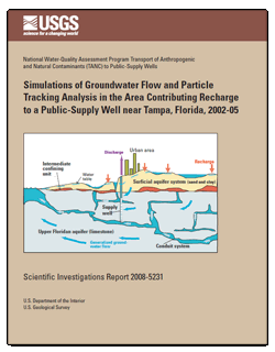
ABSTRACTShallow ground water in the north-central Tampa Bay region, Florida, is affected by elevated nitrate concentrations, the presence of volatile organic compounds, and pesticides as a result of groundwater development and intensive urban land use. The region relies primarily on groundwater for drinking-water supplies. Sustainability of groundwater quality for public supply requires monitoring and understanding of the mechanisms controlling the vulnerability of public-supply wells to contamination. A single public-supply well was selected for intensive study based on the need to evaluate the dominant processes affecting the vulnerability of public-supply wells in the Upper Floridan aquifer in the City of Temple Terrace near Tampa, Florida, and the presence of a variety of chemical constituents in water from the well. A network of 29 monitoring wells was installed, and water and sediment samples were collected within the area contributing recharge to the selected public-supply well to support a detailed analysis of physical and chemical conditions and processes affecting the water chemistry in the well. A three-dimensional, steady-state groundwater flow model was developed to evaluate the age of groundwater reaching the well and to test hypotheses on the vulnerability of the well to nonpoint source input of nitrate. Particle tracking data were used to calculate environmental tracer concentrations of tritium and sulfur hexafluoride and to calibrate traveltimes and compute flow paths and advective travel times in the model area. The traveltime of particles reaching the selected public-supply well ranged from less than 1 day to 127.0 years, with a median of 13.1 years; nearly 45 percent of the simulated particle ages were less than about 10 years. Nitrate concentrations, derived primarily from residential/commercial fertilizer use and atmospheric deposition, were highest (2.4 and 6.11 milligrams per liter as nitrogen, median and maximum, respectively) in shallow groundwater from the surficial aquifer system and lowest (less than the detection level of 0.06 milligram per liter) in the deeper Upper Floridan aquifer. Denitrification occurred near the interface of the surficial aquifer system and the underlying intermediate confining unit, within the intermediate confining unit, and within the Upper Floridan aquifer because of reducing conditions in this part of the flow system. However, simulations indicate that the rapid movement of water from the surficial aquifer system to the selected public-supply well through karst features (sinkholes) and conduit layers that bypass the denitrifying zones (short-circuits), coupled with high pumping rates, allow nitrate to reach the selected public-supply well in concentrations that resemble those of the overlying surficial aquifer system. Water from the surficial aquifer system with elevated concentrations of nitrate and low concentrations of some volatile organic compounds and pesticides is expected to continue moving into the selected public-supply well, because calculated flux-weighted concentrations indicate the proportion of young affected water contributing to the well is likely to remain relatively stable over time. The calculated nitrate concentration in the selected public-supply well indicates a lag of 1 to 10 years between peak concentrations of nonpoint source contaminants in recharge and appearance in the well. |
Posted November 19, 2009
For additional information contact: Part or all of this report is presented in Portable Document Format (PDF); the latest version of Adobe Reader or similar software is required to view it. Download the latest version of Adobe Reader, free of charge. |
Crandall, C.A., Kauffman, L.J., Katz, B.G., Metz, P.A., McBride, W.S., and Berndt, M.P., 2009, Simulations of groundwater flow and particle tracking analysis in the area contributing recharge to a public-supply well near Tampa, Florida, 2002-05, U.S. Geological Survey Scientific Investigations Report 2008-5231, 53 p.
Foreword
Acknowledgments
Abstract
Introduction
Purpose and Scope
Previous Studies
Description of Study Area
Climate
Population and Land Use
Physiography
Surface-Water and Groundwater Interactions
Hydrogeologic Setting
Geology
Lithology
Groundwater Flow System
Methods
Design of Sampling Network and Data Collection and Analysis
Development and Calibration of Local-Scale Groundwater Flow and Particle Tracking Model
Groundwater Flow and Advective Tracking Simulation
Model Uncertainties and Limitations
Model Geometry and Discretization
Boundary Conditions and Model Stresses
Description of Lateral Boundaries
Simulation of Recharge and Discharge
Pumping
Hydraulic and Other Estimated Parameters
Hydraulic Parameters
Recharge Parameters
Other Parameters
Parameter Sensitivity
Simulation of Particle Tracking
Calibration
Water Levels and Water-Level Gradients
Flow Patterns
Water Budget
Particle Tracking
Age Tracer Concentrations
Simulated Particle Ages
Comparison of Land Use in the Area Contributing Recharge and Occurrence of Selected Contaminants
Long-Term Concentrations of Nitrate in the Public-Supply Well
Summary and Conclusions
References Cited
Appendix

![]() U.S. Department of the Interior |
U.S. Geological Survey
U.S. Department of the Interior |
U.S. Geological Survey
[an error occurred while processing this directive]
URL: http://pubsdata.usgs.gov
Page Contact Information: Contact USGS
Page Last Modified: Thursday, 10-Jan-2013 19:06:13 EST
