Scientific Investigations Report 2009–5004

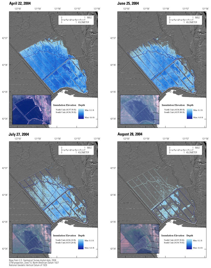
Figure 3. Observed and modeled extent of inundation and depth to water at the Wood River Wetland, Oregon, April–August 2004. (Observed inundation [insets] obtained from Landsat 7 imagery for the specified date using false color to emphasize inundation. Modeled inundation derived from a digital elevation model based on LiDAR [Light Detection And Ranging] data.) |
For additional information contact: Part or all of this report is presented in Portable Document Format (PDF); the latest version of Adobe Reader or similar software is required to view it. Download the latest version of Adobe Reader, free of charge. |