Scientific Investigations Report 2009–5025
U.S. GEOLOGICAL SURVEY
Scientific Investigations Report 2009–5025
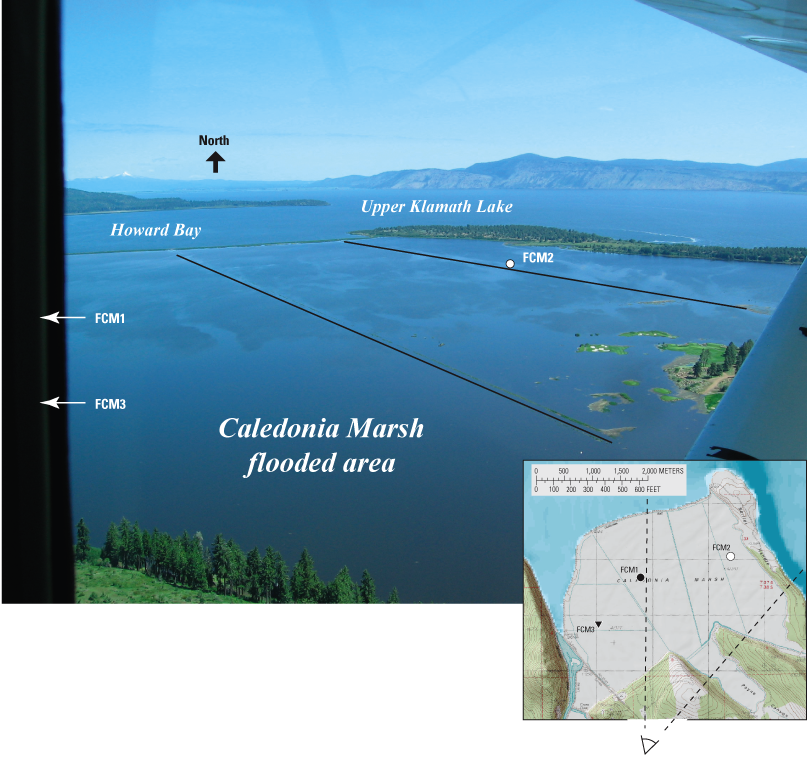
Figure 5. Two of the three internal levees (marked by black lines) separating water quality sampling site FCM2 from the external levee breach that opened flooded Caledonia Marsh to Upper Klamath Lake, Oregon, June 9, 2006. Breach is to the left of the photograph.

![]() U.S. Department of the Interior | U.S. Geological Survey
U.S. Department of the Interior | U.S. Geological Survey
URL: http://pubs.usgs.gov/sir/2009/5025
Page Contact Information: Publications Team
Page Last Modified: Thursday, 10-Jan-2013 19:24:44 EST
