Scientific Investigations Report 2009–5030
U.S. GEOLOGICAL SURVEY
Scientific Investigations Report 2009–5030
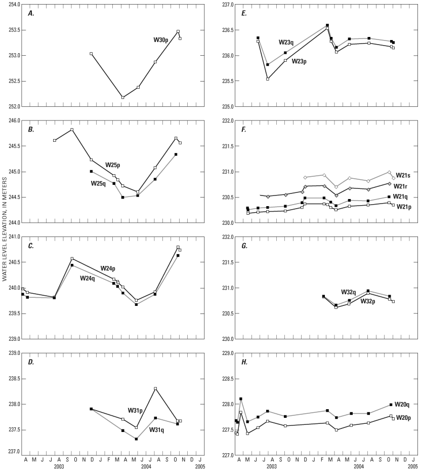
Figure 6. Water levels in well pairs in the DR2 catchment, Yakima River basin, Washington. (The single well at site W30 is shown for comparison purposes only; suffix p indicates the shallowest well at each site; q, r, and s indicate increasingly deeper wells, respectively.)

![]() U.S. Department of the Interior | U.S. Geological Survey
U.S. Department of the Interior | U.S. Geological Survey
URL: http://pubs.usgs.gov/
Page Contact Information: Publications Team
Page Last Modified: Thursday, 10-Jan-2013 19:26:55 EST
