Scientific Investigations Report 2009–5078

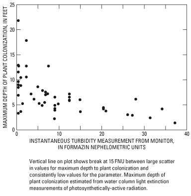
Figure 26. Estimated maximum depths of plant colonization and instantaneous turbidity between RM 116 and RM 8, Yakima River, and between RM 12 and RM 3.5, Naches River, Washington, March 1–September 30, 2005–07. |
For additional information contact: Part or all of this report is presented in Portable Document Format (PDF); the latest version of Adobe Reader or similar software is required to view it. Download the latest version of Adobe Reader, free of charge. |