Scientific Investigations Report 2009–5078
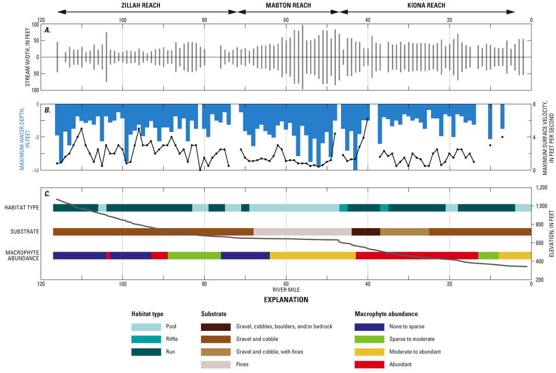
Figure 6. Results from 2004 assessment of the lower Yakima River, including (A) stream width, (B) maximum water depth and maximum surface velocity, and (C) elevation profile, habitat and substrate types, and macrophyte abundance in the lower Yakima River, Washington, June 14–18, 2004. |
For additional information contact: Part or all of this report is presented in Portable Document Format (PDF); the latest version of Adobe Reader or similar software is required to view it. Download the latest version of Adobe Reader, free of charge. |

![]() U.S. Department of the Interior | U.S. Geological Survey
U.S. Department of the Interior | U.S. Geological Survey
URL: http://
pubsdata.usgs.gov
/pubs/sir/2009/5078/figure6.html
Page Contact Information: Contact USGS
Page Last Modified:
Thursday, 10-Jan-2013 19:30:04 EST
