Scientific Investigations Report 2009–5208
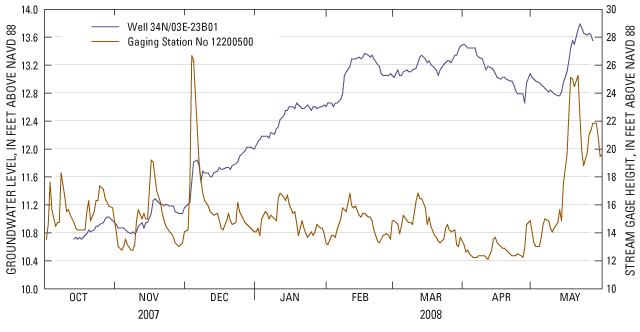
Figure 12. Water levels in well 34N/03E-23B01 and stream stage at U.S. Geological Survey streamflow-gaging station 12200500, Skagit River near Mount Vernon, Washington, October 2007 through May 2008. |
For additional information contact: Part or all of this report is presented in Portable Document Format (PDF); the latest version of Adobe Reader or similar software is required to view it. Download the latest version of Adobe Reader, free of charge. |

![]() U.S. Department of the Interior | U.S. Geological Survey
U.S. Department of the Interior | U.S. Geological Survey
URL: http://
pubsdata.usgs.gov
/pubs/sir/2009/5208/figure12.html
Page Contact Information: Contact USGS
Page Last Modified:
Thursday, 10-Jan-2013 19:38:21 EST
