Scientific Investigations Report 2009–5228
 
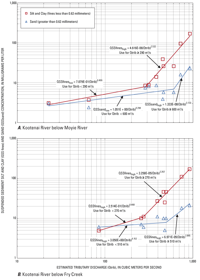
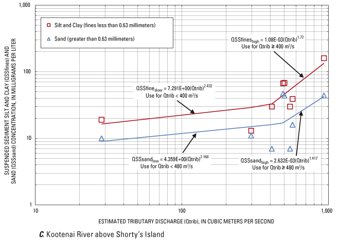
Figure 7. Estimated tributary discharge and sediment transport curves for suspended sediment silt and clay and sand concentration, (A) Kootenai River below Moyie River, (B) Kootenai River below Fry Creek, and (C) Kootenai River above Shorty’s Island, near Bonners Ferry, Idaho. |
For additional information contact: Part or all of this report is presented in Portable Document Format (PDF); the latest version of Adobe Reader or similar software is required to view it. Download the latest version of Adobe Reader, free of charge. |