Scientific Investigations Report 2010–5065

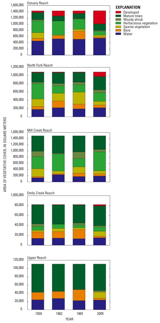
Figure 16. Changes in flood-plain land cover by reach, Chetco River, Oregon, 1939–2005. Upper Reach data include only the 0.5 km length of flood plain covered by the aerial photographs from 1939. |
First posted May 26, 2010 For additional information contact: Part or all of this report is presented in Portable Document Format (PDF); the latest version of Adobe Reader or similar software is required to view it. Download the latest version of Adobe Reader, free of charge. |