Scientific Investigations Report 2010–5065

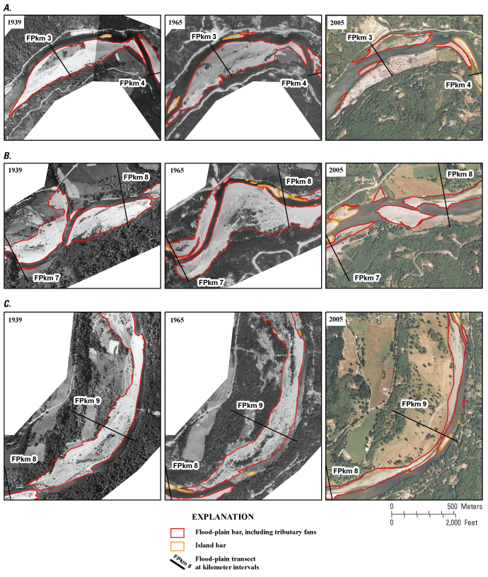
Figure 21. Examples of bar evolution to flood-plain and developed areas between 1939 and 2005, Chetco River, Oregon. (A) Gravel bar near flood-plain kilometer (FPkm) 3 (Estuary Reach) evolving to developed area. (B) Dynamic bars between flood-plain kilometers 7 and 9 (North Fork and Mill Creek reaches). (C) Example of vegetation colonization on upper bar surface near flood-plain kilometer 9 (Mill Creek Reach). |
First posted May 26, 2010 For additional information contact: Part or all of this report is presented in Portable Document Format (PDF); the latest version of Adobe Reader or similar software is required to view it. Download the latest version of Adobe Reader, free of charge. |