Scientific Investigations Report 2010–5065
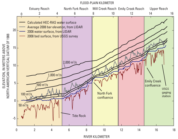
Figure 25. Surveyed channel thalweg in 2008 (USGS survey), water-surface (from LIDAR topography, discharge approximately 7.8 cubic meters per second), bar surfaces (from LIDAR topography), and water-surface profiles as calculated from HEC-RAS for flows between 50 and 2,000 cubic meters per second for the lower Chetco River, Oregon. |
First posted May 26, 2010 For additional information contact: Part or all of this report is presented in Portable Document Format (PDF); the latest version of Adobe Reader or similar software is required to view it. Download the latest version of Adobe Reader, free of charge. |

![]() U.S. Department of the Interior | U.S. Geological Survey
U.S. Department of the Interior | U.S. Geological Survey
URL: http://
pubsdata.usgs.gov
/pubs/sir/2010/5065/figure25.html
Page Contact Information: Contact USGS
Page Last Modified:
Thursday, 10-Jan-2013 19:10:08 EST
