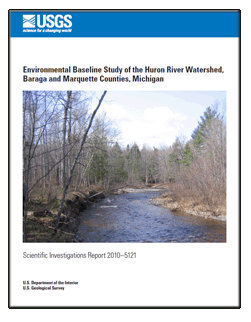
Scientific Investigations Report 2010-5121

AbstractThis report summarizes results of a study to establish water-quality and geochemical baseline conditions within a small watershed in the Lake Superior region. In 2008, the U.S. Geological Survey (USGS) completed a survey of water-quality parameters and soil and streambed sediment geochemistry of the 83 mi2 Huron River Watershed in the Upper Peninsula of Michigan. Streamflow was measured and water-quality samples collected at a range of flow conditions from six sites on the major tributaries of the Huron River. All water samples were analyzed for a suite of common ions, nutrients, and trace metals. In addition, water samples from each site were analyzed for unfiltered total and methylmercury once during summer low-flow conditions. Soil samples were collected from 31 sites, with up to 4 separate samples collected at each site, delineated by soil horizon. Streambed sediments were collected from 11 sites selected to cover most of the area drained by the Huron River system. USGS data were supplemented with ecological assessments completed in 2006 by the Michigan Department of Environmental Quality using a modified version of their Great Lakes Environmental Assessment Section procedure 51, and again during 2008 using volunteers under supervision of the Michigan Department of Natural Resources. Results from this study define a hydrological, geological, and environmental baseline for the Huron River Watershed prior to any significant mineral exploration or development. Results from the project also serve to refine the design of future regional environmental baseline studies in the Lake Superior Basin. |
Posted August 2010 For additional information contact: Part or all of this report is presented in Portable Document Format (PDF); the latest version of Adobe Reader or similar software is required to view it. Download the latest version of Adobe Reader, free of charge. |
Woodruff, L.G., Weaver, T.L., and Cannon, W.F., 2010, Environmental baseline study of the Huron River Watershed, Baraga and Marquette Counties, Michigan: U.S. Geological Survey Scientific Investigations Report 2010–5121, 64 p., available at http://pubs.usgs.gov/sir/2010/5121/.
Abstract
Introduction
Description of the Huron River Watershed
Climate
Physiography
Bedrock Geology
Glacial Geology
Soils
Previous Studies in the Huron River Watershed
Methods of Data Collection and Analysis
Streamflow Measurement and Water-Quality Sampling
Streamflow Measurement
Water-Quality Sampling
Water-Quality Reporting Levels and Analysis
Quality Assurance
Soils and Stream Sediments
Soil Sampling
Streambed Sediment Sampling
Chemical Analyses
Quality Assurance and Quality Control for Soils and Streambed Sediments
Statistical Methods for Soil and Streambed Sediment Data
Ecological Assessment
Fishes
Streamflow
East Branch Huron River, Downstream of East Branch Falls
Tributary to East Branch Huron River
West Branch Huron River
Robarge Creek
Black Creek
Huron River at Big Eric’s Bridge
Results and Discussion
Water Quality of Streams in the Huron River Watershed
Field Water-Quality Parameters, Major Ions, and Alkalinity
Nutrients
Manganese, Nickel, Zinc, and Copper
Mercury
Soils and Streambed Sediments
Total Digestion for Soils
Vertical Variability among Soil Horizons
Lateral Variability for Soils
Total Digestion of Streambed Sediments
Partial Digestion of Soils and Streambed Sediments
Ecological Assessment
Michigan Department of Environmental Quality (MDEQ) Study Results
Michigan Department of Natural Resources (MDNR) Study Results
Future Baseline Studies in the Lake Superior Basin
Water-Quality Sampling
Soil and Streambed Sediment Sampling
Acknowledgments
References Cited
Appendix 1. List of Abbreviations
Appendixes 2, 3, 4, and 5