Scientific Investigations Report 2010–5128
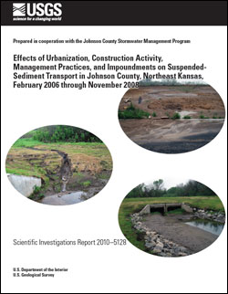
AbstractThe U.S. Geological Survey, in cooperation with the Johnson County, Kansas, Stormwater Management Program, investigated the effects of urbanization, construction activity, management practices, and impoundments on suspended-sediment transport in Johnson County from February 2006 through November 2008. Streamgages and continuous turbidity sensors were operated at 15 sites within the urbanizing 57-square-mile Mill Creek Basin, and 4 sites downstream from the other largest basins (49 to 66 square miles) in Johnson County. The largest sediment yields in Johnson County were observed downstream from basins with increased construction activity. Sediment yields attributed to the largest (68 acre) active construction site in the study area were 9,300 tons per square mile in 2007 and 12,200 tons per square mile in 2008; 5 to 55 times larger than yields observed at other sampling sites. However, given erodible soils and steep slopes at this site, sediment yields were relatively small compared to the range in historic values from construction sites without erosion and sediment controls in the United States (2,300 to 140,000 tons per square mile). Downstream from this construction site, a sediment forebay and wetland were constructed in series upstream from Shawnee Mission Lake, a 120-acre reservoir within Shawnee Mission Park. Although the original intent of the sediment forebay and constructed wetland were unrelated to upstream construction, they were nonetheless evaluated in 2008 to characterize sediment removal before stream entry into the lake. The sediment forebay was estimated to reduce 33 percent of sediment transported to the lake, whereas the wetland did not appear to decrease downstream sediment transport. Comparisons of time-series data and relations between turbidity and sediment concentration indicate that larger silt-sized particles were deposited within the sediment forebay, whereas smaller silt and clay-sized sediments were transported through the wetland and into the lake. Data collected at sites up and downstream from the constructed wetland indicated that hydraulic retention alone did not substantially reduce sediment loading to Shawnee Mission Lake. Mean-daily turbidity values at sampling sites downstream from basins with increased construction activity were compared to U.S. Environmental Protection Agency turbidity criteria designed to reduce discharge of pollutants from construction sites. The U.S. Environmental Protection Agency numeric turbidity criteria specifies that effluent from construction sites greater than 20 acres not exceed a mean-daily turbidity value of 280 nephelometric turbidity units beginning in 2011; this criteria will apply to sites greater than 10 acres beginning in 2014. Although numeric criteria would not have been applicable to data from sampling sites in Johnson County because they were not directly downstream from construction sites and because individual states still have to determine additional details as to how this criteria will be enforced, comparisons were made to characterize the potential of construction site effluent in Johnson County to exceed U.S. Environmental Protection Agency Criteria, even under extensive erosion and sediment controls. Numeric criteria were exceeded at sampling sites downstream from basins with increased construction activity for multiple days during the study period, potentially indicating the need for additional erosion and sediment controls and (or) treatment to bring discharges from construction sites into compliance with future numeric turbidity criteria. Among sampling sites in the Mill Creek Basin, sediment yields from the urbanizing Clear Creek Basin were approximately 2 to 3 times those from older, more stable urban or rural basins. Sediments eroded from construction sites adjacent to or surrounding streams appear to be more readily transported downstream, whereas sediments eroded from construction sites in headwater areas are more likely to be deposited locally on land surfaces or within the stream network. Comparison of sediment yields among headwater and downstream sites in the Clear Creek Basin indicated that factors such as site and stream slope, the current phase of construction, management practices, and site location relative to streams affect the amount and length of time it takes eroded sediment to be transported downstream. Sediment concentrations in Mill Creek tributaries downstream from increased construction activity were larger than other sites for a much longer period of time, likely decreasing light penetration and increasing fine sediment deposition on streambeds. Subbasins partially regulated by impoundments and those with stable urban land use had the smallest sediment concentrations and loads in the Mill Creek Basin. The most extreme streamflows transported the most sediment throughout the Mill Creek Basin. Streamflows that occurred less than 1 percent of the time transported 73 to 91 percent of sediment loads, whereas streamflows that occurred less than 10 percent of the time transported 93 to 100 percent of sediment loads. Multiple regression analysis of the factors affecting sediment transport indicated the largest, most intense storms transport substantially larger sediment loads at all sampling sites. Large storms decreased sediment supplies available for transport by subsequent storms. Contrary to results observed from smaller subbasins within the Mill Creek Basin, sediment yields from the predominantly mature, urban Indian Creek Basin were more than double those from other large urbanizing and rural (49 to 66 square miles) basins in Johnson County from 2006 through 2008. Larger sediment loads in the Indian Creek Basin likely originate from frequent stormflows that erode streambed and streambank sediments. Variation in sediment yields among other large basins in Johnson County are likely related to differences in the number and location of large impoundments and the magnitude and location of urban construction. |
First posted August 30, 2010 For additional information contact: Part or all of this report is presented in Portable Document Format (PDF); the latest version of Adobe Reader or similar software is required to view it. Download the latest version of Adobe Reader, free of charge. |
Lee, C.J., and Ziegler, A.C., 2010, Effects of urbanization, construction activity, management practices, and impoundments on suspended-sediment transport in Johnson County, northeast Kansas, February 2006 through November 2008: U.S. Geological Survey Scientific Investigations Report 2010–5128, 54 p.
Abstract
Introduction
Methods
Sediment Transport in Johnson County, Kansas
Summary and Conclusions
References Cited

![]() U.S. Department of the Interior |
U.S. Geological Survey
U.S. Department of the Interior |
U.S. Geological Survey
URL: http://pubsdata.usgs.gov/pubs/sir/2010/5128/index.html
Page Contact Information: GS Pubs Web Contact
Page Last Modified: Thursday, 10-Jan-2013 19:16:10 EST
