ABSTRACT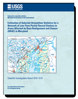
The U.S. Geological Survey, in cooperation with the Maryland Department of the Environment, operated a network of 20 low-flow partial-record stations during 2008 in a region that extends from southwest of Baltimore to the northeastern corner of Maryland to obtain estimates of selected streamflow statistics at the station locations. The study area is expected to face a substantial influx of new residents and businesses as a result of military and civilian personnel transfers associated with the Federal Base Realignment and Closure Act of 2005. The estimated streamflow statistics, which include monthly 85-percent duration flows, the 10-year recurrence-interval minimum base flow, and the 7-day, 10-year low flow, are needed to provide a better understanding of the availability of water resources in the area to be affected by base-realignment activities.
Streamflow measurements collected for this study at the low-flow partial-record stations and measurements collected previously for 8 of the 20 stations were related to concurrent daily flows at nearby index streamgages to estimate the streamflow statistics. Three methods were used to estimate the streamflow statistics and two methods were used to select the index streamgages. Of the three methods used to estimate the streamflow statistics, two of them—the Moments and MOVE1 methods—rely on correlating the streamflow measurements at the low-flow partial-record stations with concurrent streamflows at nearby, hydrologically similar index streamgages to determine the estimates. These methods, recommended for use by the U.S. Geological Survey, generally require about 10 streamflow measurements at the low-flow partial-record station. The third method transfers the streamflow statistics from the index streamgage to the partial-record station based on the average of the ratios of the measured streamflows at the partial-record station to the concurrent streamflows at the index streamgage. This method can be used with as few as one pair of streamflow measurements made on a single streamflow recession at the low-flow partial-record station, although additional pairs of measurements will increase the accuracy of the estimates. Errors associated with the two correlation methods generally were lower than the errors associated with the flow-ratio method, but the advantages of the flow-ratio method are that it can produce reasonably accurate estimates from streamflow measurements much faster and at lower cost than estimates obtained using the correlation methods.
The two index-streamgage selection methods were (1) selection based on the highest correlation coefficient between the low-flow partial-record station and the index streamgages, and (2) selection based on Euclidean distance, where the Euclidean distance was computed as a function of geographic proximity and the basin characteristics: drainage area, percentage of forested area, percentage of impervious area, and the base-flow recession time constant, τ. Method 1 generally selected index streamgages that were significantly closer to the low-flow partial-record stations than method 2. The errors associated with the estimated streamflow statistics generally were lower for method 1 than for method 2, but the differences were not statistically significant.
The flow-ratio method for estimating streamflow statistics at low-flow partial-record stations was shown to be independent from the two correlation-based estimation methods. As a result, final estimates were determined for eight low-flow partial-record stations by weighting estimates from the flow-ratio method with estimates from one of the two correlation methods according to the respective variances of the estimates. Average standard errors of estimate for the final estimates ranged from 90.0 to 7.0 percent, with an average value of 26.5 percent. Average standard errors of estimate for the weighted estimates were, on average, 4.3 percent less than the best average standard errors of estimate from the separate estimation methods.
|
First posted December 2010
Part or all of this report is presented in Portable Document Format (PDF); the latest version of Adobe Reader or similar software is required to view it. Download the latest version of Adobe Reader, free of charge. |

