Scientific Investigations Report 2010–5214
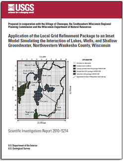
AbstractGroundwater use from shallow, high-capacity wells is expected to increase across southeastern Wisconsin in the next decade (2010–2020), owing to residential and business growth and the need for shallow water to be blended with deeper water of lesser quality, containing, for example, excessive levels of radium. However, this increased pumping has the potential to affect surface-water features. A previously developed regional groundwater-flow model for southeastern Wisconsin was used as the starting point for a new model to characterize the hydrology of part of northwestern Waukesha County, with a particular focus on the relation between the shallow aquifer and several area lakes. An inset MODFLOW model was embedded in an updated version of the original regional model. Modifications made within the inset model domain include finer grid resolution; representation of Beaver, Pine, and North Lakes by use of the LAK3 package in MODFLOW; and representation of selected stream reaches with the SFR package. Additionally, the inset model is actively linked to the regional model by use of the recently released Local Grid Refinement package for MODFLOW–2005, which allows changes at the regional scale to propagate to the local scale and vice versa. The calibrated inset model was used to simulate the hydrologic system in the Chenequa area under various weather and pumping conditions. The simulated model results for base conditions show that groundwater is the largest inflow component for Beaver Lake (equal to 59 percent of total inflow). For Pine and North Lakes, it is still an important component (equal, respectively, to 16 and 5 percent of total inflow), but for both lakes it is less than the contribution from precipitation and surface water. Severe drought conditions (simulated in a rough way by reducing both precipitation and recharge rates for 5 years to two-thirds of base values) cause correspondingly severe reductions in lake stage and flows. The addition of a test well south of Chenequa at a pumping rate of 47 gal/min from a horizon approximately 200 feet below land surface has little effect on lake stages or flows even after 5 years of pumping. In these scenarios, the stage and the surface-water outflow from Pine Lake are simulated to decrease by only 0.03 feet and 3 percent, respectively, relative to base conditions. Likely explanations for these limited effects are the modest pumping rate simulated, the depth of the test well, and the large transmissivity of the unconsolidated aquifer, which allows the well to draw water from upstream along the bedrock valley and to capture inflow from the Bark River. However, if the pumping rate of the test well is assumed to increase to 200 gal/min, the decrease in simulated Pine Lake outflow is appreciably larger, dropping by 14 percent relative to base-flow conditions. |
Posted August 2011 For additional information contact: Internet: http://wi.water.usgs.gov/ Part or all of this report is presented in Portable Document Format (PDF); the latest version of Adobe Reader or similar software is required to view it. Download the latest version of Adobe Reader, free of charge. |
Feinstein, D.T., Dunning, C.P., Juckem, P.F., and Hunt, R.J., 2010, Application of the Local Grid Refinement package to an inset model simulating the interactions of lakes, wells, and shallow groundwater, northwestern Waukesha County, Wisconsin: U.S. Geological Survey Scientific Investigations Report 2010–5214, 30 p., available at http://pubs.usgs.gov/sir/2010/5214/.
Abstract
Introduction
Southeastern Wisconsin Background Regional Model
Child Model Embedded in Parent Regional Model
Calibration of the Child Model
Model Results
Discussion
Model Limitations
Summary and Conclusions
References Cited

![]() U.S. Department of the Interior |
U.S. Geological Survey
U.S. Department of the Interior |
U.S. Geological Survey
URL: http://pubsdata.usgs.gov/pubs/sir/2010/5214/index.html
Page Contact Information: GS Pubs Web Contact
Page Last Modified: Thursday, 10-Jan-2013 19:24:05 EST
