Scientific Investigations Report 2010–5230
ABSTRACT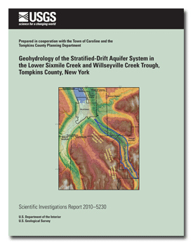
In 2002, the U.S. Geological Survey, in cooperation with the Tompkins County Planning Department began a series of studies of the stratified-drift aquifers in Tompkins County to provide geohydrologic data for planners to develop a strategy to manage and protect their water resources. This aquifer study in lower Sixmile Creek and Willseyville Creek trough is the second in a series of aquifer studies in Tompkins County. The study area is within the northern area of the Appalachian Plateau and extends about 9 miles from the boundary between Tompkins County and Tioga County in the south to just south of the City of Ithaca in the north. In lower Sixmile Creek and Willseyville Creek trough, confined sand and gravel aquifers comprise the major water-bearing units while less extensive unconfined units form minor aquifers. About 600 people who live in lower Sixmile Creek and Willseyville Creek trough rely on groundwater from the stratified-drift aquifer system. In addition, water is used by non-permanent residents such as staff at commercial facilities. The estimated total groundwater withdrawn for domestic use is about 45,000 gallons per day (gal/d) or 0.07 cubic foot per second (ft3/s) based on an average water use of 75 gal/d per person for self-supplied water systems in New York. Scouring of bedrock in the preglacial lower Sixmile Creek and Willseyville Creek valleys by glaciers and subglacial meltwaters truncated hillside spurs, formed U-shaped, transverse valley profiles, smoothed valley walls, and deepened the valleys by as much as 300 feet (ft), forming a continuous trough. The unconsolidated deposits in the study area consist mostly of glacial drift, both unstratified drift (till) and stratified drift (laminated lake, deltaic, and glaciofluvial sediments), as well as some post-glacial stratified sediments (lake-bottom sediments that were deposited in reservoirs, peat and muck that were deposited in wetlands, and alluvium deposited by streams). Multiple advances and retreats of the ice in the study area resulted in several sequences of various types of glacial deposits. A large moraine (Valley Heads Moraine) dominates the southern part of the study area, a large delta dominates the central part, and ground moraine (mostly till) dominates the northern part. Glacial sediments in the center of the lower Sixmile Creek and Willseyville Creek trough typically range from 150 to 200 ft but can be greater than 300 ft in some places. Where the sediments are composed of sand and gravel they form aquifers. In most parts of the lower Sixmile Creek and Willseyville Creek trough, there is an upper and a basal confined aquifer. However, underlying the central parts of the Brooktondale delta, there are as many as four confined aquifers, whereas in the northern part of the study area, only one extensive confined aquifer is present. The major sources of recharge to these confined aquifers are (1) direct infiltration of precipitation where confined aquifers crop out at land surface (mostly along the western trough wall in the southern and central parts of the study area and, to a lesser degree, along the eastern trough wall); (2) unchanneled surface and subsurface runoff from adjacent upland areas that seeps into the aquifer along the western trough walls; (3) subsurface flow from underlying till or bedrock at the lateral contacts at trough walls; (4) adjacent fine-grained stratified drift, especially when the aquifer is pumped; and (5) discharge from bedrock at the bottom and sides of the trough. In the central part of the study area, the surficial coarse-grained sediments (sand and gravel) comprise a delta near Brooktondale and form a small unconfined aquifer (0.3 square mile). Although much of the upper part of the delta has been removed by several aggregate mining operations, sufficient amounts of sand and gravel remain in most places to form a thin unconfined aquifer. The major sources of recharge to the unconfined aquifer are (1) direct infiltration of precipitation where water moves predominantly in a downward direction through the unsaturated zone toward the water table and (2) unchanneled surface and subsurface runoff from adjacent upland areas that seep into the aquifer along the trough walls. Groundwater in the southern part of the Brooktondale delta flows to the west and discharges into Beaver Creek. Groundwater in the northern part of the deltaic aquifer flows to the northwest where some of the groundwater discharges to springs along the northeastern margin of the delta and flows into lower Sixmile Creek and some groundwater discharges to springs along the northwestern margin of the delta and flows into Beaver Creek. Just north of the surface-water divide in the southern part of the study area groundwater in the confined aquifers on the west side of the trough initially flows eastward from the west valley wall to the center of the valley where it then changes course and flows northward. In the northern part of the central area of the trough, the upper confined aquifer either pinches out at depth or has been eroded by Sixmile Creek and is exposed beneath the floodplain where groundwater discharges directly into Sixmile Creek. In the northern part of the study area, groundwater in the confined aquifer ultimately discharges into Sixmile Creek and to the Ithaca Reservoir. An initial assessment of the groundwater quality of the confined aquifer system near the central portion of the study area, where most of the wells are located, was made by collecting water samples from six wells (two test wells and four residential wells) from December 2006 through August 2007 and analyzing the samples to characterize the quality of groundwater. Common ions, nutrients, and trace metals were sampled and field properties of pH, specific conductance, and temperature were measured. All common ions were below U.S. Environmental Protection Agency Drinking Water Advisory limits. These results indicate that water in the sand and gravel aquifers is predominantly calcium-bicarbonate, and groundwater used for drinking supply is generally of acceptable quality. Nitrate was not detected in any of the samples above the detection limit of 0.06 mg/L (milligram per liter). Nitrite was not detected in five of the six samples and was negligible (0.001 mg/L) in the sixth sample. The most commonly detected trace elements were aluminum, arsenic, barium, boron, iron, lithium, manganese, nickel, and strontium, all of which were detected in every sample. The elements detected in the highest concentrations were barium, boron, iron, lithium, manganese, strontium, and uranium. Aluminum concentrations ranged from 0.9 to 95.5 micrograms per liter (μg/L); one sample exceeded the Secondary Maximum Contaminant Level of 50 μg/L. Arsenic concentrations ranged from 1.3 to 20.4 μg/L; two samples exceeded the Federal Maximum Contaminant Level for arsenic of 10 μg/L. |
First posted March 24, 2011 For additional information contact: Part or all of this report is presented in Portable Document Format (PDF); the latest version of Adobe Reader or similar software is required to view it. Download the latest version of Adobe Reader, free of charge. |
Miller, T.S. and Karig, D.E., 2010, Geohydrology of the stratified-drift aquifer system in the lower Sixmile Creek and Willseyville Creek trough, Tompkins County, New York: U.S. Geological Survey Scientific Investigations Report 2010–5230, 54 p. (Also available at http://pubs.usgs.gov/sir/2010/5230.)
Abstract
Introduction
Purpose and Scope
Description of Study Area
Previous Studies
Data Collection
Geologic Data
Seismic Surveys
Well Inventory, Test Drilling, and Water-Level Measurements
Water Sampling and Analysis
Geology
Glacial History
Scouring by Ice
Wisconsinan Deposits in the Study Area
Southern Part of Study Area
Central Part of the Study Area
Northern Part of the Study Area
Hydrology of the Stratified-Drift Aquifer System
Aquifer Types
Aquifer Geometry
Unconfined Headwater Aquifer
Unconfined Deltaic Aquifer
Confined and Locally Unconfined Aquifers
Bedrock Aquifers
Groundwater Levels and Flowpaths
Sources of Recharge
Unconfined Aquifers
Confined Aquifers
Groundwater Discharge
Unconfined Aquifer at the Brooktondale Delta
Confined Aquifers
Pumping Withdrawals
Groundwater Quality
Physical Properties
Major Inorganic Ions
Nutrients
Trace Elements
Comparison to Other Stratified-Drift Aquifers in Tompkins County
Summary
Selected References
Appendix 1. Records of selected wells in lower Sixmile Creek and Willseyville Creek trough, Tompkins and Tioga Counties, New York

![]() U.S. Department of the Interior |
U.S. Geological Survey
U.S. Department of the Interior |
U.S. Geological Survey
[an error occurred while processing this directive]
URL: http://pubsdata.usgs.gov
Page Contact Information: Contact USGS
Page Last Modified: Thursday, 10-Jan-2013 19:23:59 EST
