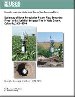
Scientific Investigations Report 2011–5001

Water management and determination of consumptive water use in irrigated agricultural settings depend on understanding factors such as surface-water diversions, groundwater withdrawals, evapotranspiration, tail-water runoff, and deep-percolation return flow of water beneath irrigated fields. To improve understanding of deep-percolation return flow beneath irrigated fields, the U.S. Geological Survey, in cooperation with the Central Colorado Water Conservancy District, conducted a study to estimate deep-percolation return flow at two irrigated sites in the Central Colorado Water Conservancy District during the 2008 and 2009 irrigation seasons. At one site, deep percolation was monitored beneath an agricultural field irrigated by flood furrows, and at a second site, deep percolation was monitored beneath an agricultural field irrigated by a center-pivot sprinkler. Deep-percolation return flow at each site was estimated by using an unsaturated zone water-balance method and the water-table fluctuation method, and the ratio of deep percolation to applied water (irrigation and irrigation plus precipitation) was computed for each site. Cumulative deep percolation at the flood-irrigated site was estimated to range from 7.7 to 8.8 in. during the monitoring periods, which is about 40–52 percent of irrigation water applied during the same periods and about 29–39 percent of irrigation water plus precipitation during those periods. Deep percolation at the sprinkler-irrigated site was estimated to range from 1.2 to 3.2 in. during the monitoring periods, which is about 5–14 percent of irrigation water applied during the periods and about 4–11 percent of irrigation water plus precipitation during the periods. |
First posted February 22, 2011 For additional information contact: This report is presented in Portable Document Format (PDF); the latest version of Adobe Reader or similar software is required to view it. Download the latest version of Adobe Reader, free of charge. |
Arnold, L.R., 2011, Estimates of deep-percolation return flow beneath a flood- and a sprinkler-irrigated site in Weld County, Colorado, 2008–2009: U.S. Geological Survey Scientific Investigations Report 2011–5001, 225 p.
Abstract
Introduction
Purpose and Scope
Study Area Description
Site Selection and Instrumentation
Estimates of Deep-Percolation Return Flow
Analytical Methods
Unsaturated Zone Water-Balance Method
Water-Table Fluctuation Method
Deep-Percolation Return Flow at the Flood-Irrigated Site
Deep-Percolation Return Flow at the Sprinkler-Irrigated Site
Summary
Acknowledgments
References Cited
Appendixes