Scientific Investigations Report 2011–5041
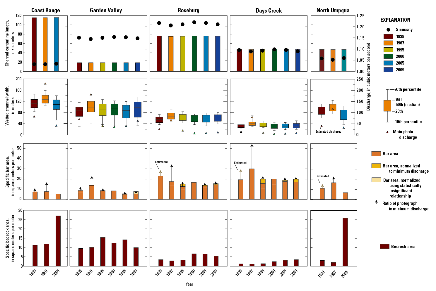
Figure 18. Summary of historical channel change 1939-2009 for fluvial reaches in the Umpqua River Basin, Oregon. The total area of gravel bars and bedrock in each reach was divided by the centerline length from 2005 to determine the specific area of bars and bedrock in each reach. Arrows in bar area plot show ratio of photograph discharge to minimum photograph discharge for each reach and indicate magnitude of bias introduced by variation in photograph discharge. |
First posted September 29, 2011 For additional information contact: Part or all of this report is presented in Portable Document Format (PDF); the latest version of Adobe Reader or similar software is required to view it. Download the latest version of Adobe Reader, free of charge. |

![]() U.S. Department of the Interior |
U.S. Geological Survey
U.S. Department of the Interior |
U.S. Geological Survey
URL: http://pubsdata.usgs.gov/pubs/sir/2011/5041/figure18.html
Page Contact Information: GS Pubs Web Contact
Page Last Modified: Thursday, 10-Jan-2013 20:11:14 EST
