Scientific Investigations Report 2011–5041
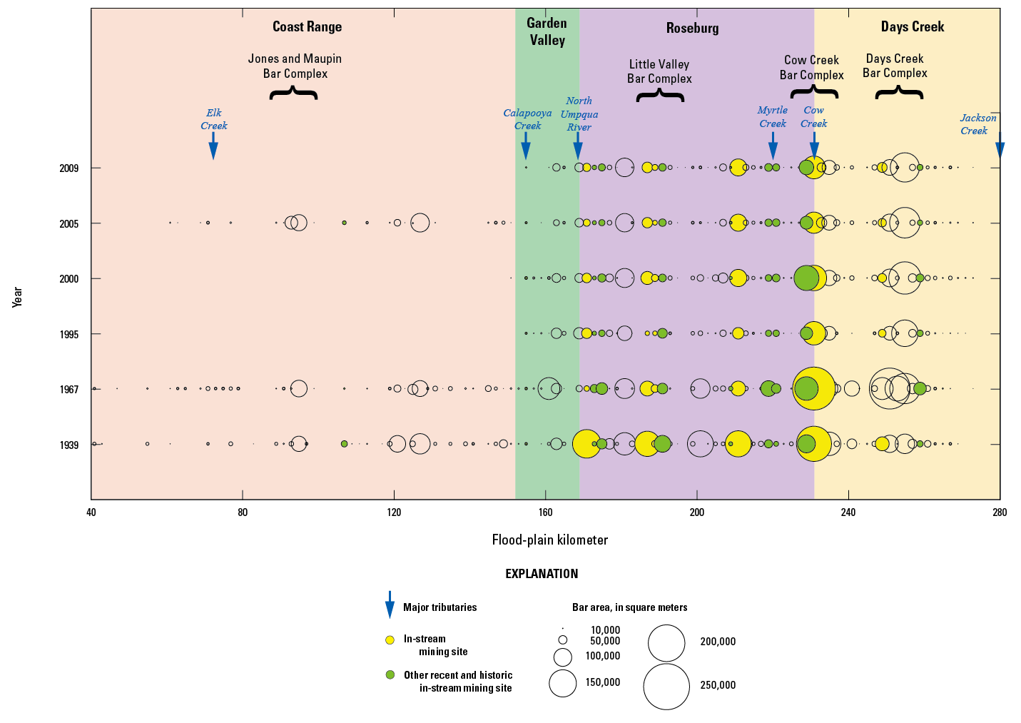
Figure 20. Size and location of mapped gravel bars along the South Umpqua and Umpqua Rivers, Oregon, 1939–2005. Each circle represents the total bar area, aggregated every two flood-plain kilometer transects, and does not necessarily correspond to individual bars. Bar complexes are arbitrary names assigned to particularly gravel-rich areas and may include multiple bars. |
First posted September 29, 2011 For additional information contact: Part or all of this report is presented in Portable Document Format (PDF); the latest version of Adobe Reader or similar software is required to view it. Download the latest version of Adobe Reader, free of charge. |

![]() U.S. Department of the Interior |
U.S. Geological Survey
U.S. Department of the Interior |
U.S. Geological Survey
URL: http://pubsdata.usgs.gov/pubs/sir/2011/5041/figure20.html
Page Contact Information: GS Pubs Web Contact
Page Last Modified: Thursday, 10-Jan-2013 20:11:15 EST
