Scientific Investigations Report 2011–5041
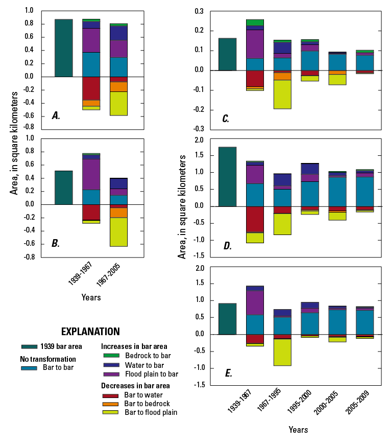
Figure 21. Reach-segregated changes in bar area in the Umpqua River basin, Oregon, 1939–2005. Positive balance represents net bar area in each time period separated according to areas that were previously mapped as bars, and newly created bars that were previously mapped as water, flood plain, or bedrock. Negative balances represent total decreases in bar area, separated into areas that became water, bedrock, or flood plain. (A) Coast Range, (B) North Umpqua, (C) Garden Valley, (D) Roseburg, (E) Days Creek. |
First posted September 29, 2011 For additional information contact: Part or all of this report is presented in Portable Document Format (PDF); the latest version of Adobe Reader or similar software is required to view it. Download the latest version of Adobe Reader, free of charge. |

![]() U.S. Department of the Interior |
U.S. Geological Survey
U.S. Department of the Interior |
U.S. Geological Survey
URL: http://pubsdata.usgs.gov/pubs/sir/2011/5041/figure21.html
Page Contact Information: GS Pubs Web Contact
Page Last Modified: Thursday, 10-Jan-2013 20:11:16 EST
