Scientific Investigations Report 2011–5041
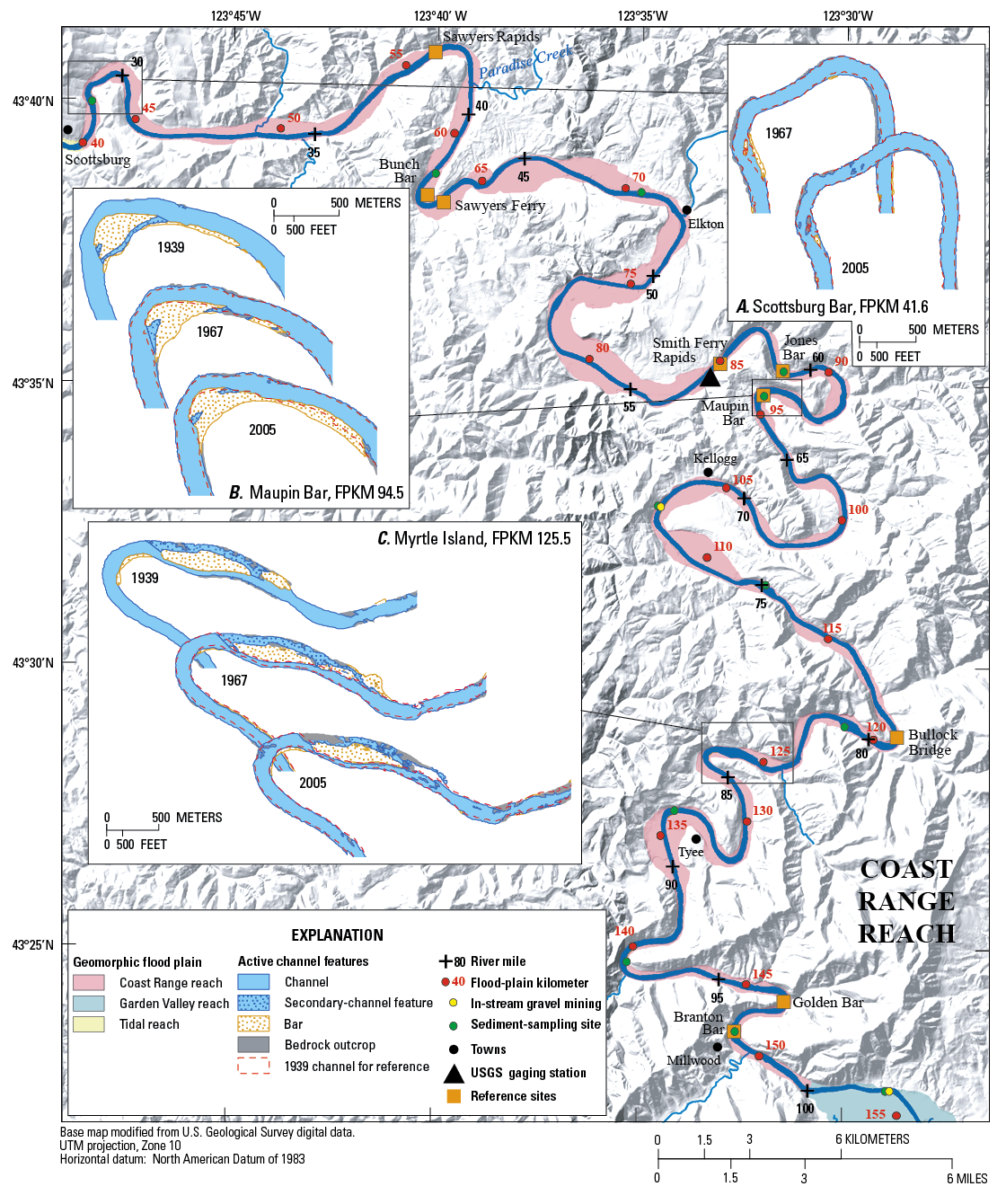
Figure 7. Channel planform in the Coast Range reach of the Umpqua River, Oregon. Insets show historical changes to selected bars, as mapped from aerial photographs. Topography based on U.S. Geological Survey 10-meter digital elevation data. |
First posted September 29, 2011 For additional information contact: Part or all of this report is presented in Portable Document Format (PDF); the latest version of Adobe Reader or similar software is required to view it. Download the latest version of Adobe Reader, free of charge. |

![]() U.S. Department of the Interior |
U.S. Geological Survey
U.S. Department of the Interior |
U.S. Geological Survey
URL: http://pubsdata.usgs.gov/pubs/sir/2011/5041/figure7.html
Page Contact Information: GS Pubs Web Contact
Page Last Modified: Thursday, 10-Jan-2013 20:11:06 EST
