Scientific Investigations Report 2011–5176
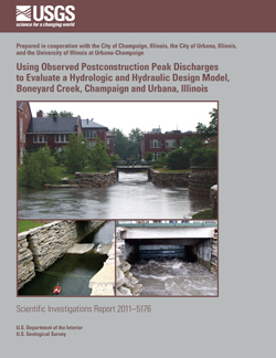
AbstractBoneyard Creek—which drains an urbanized watershed in the cities of Champaign and Urbana, Illinois, including part of the University of Illinois at Urbana-Champaign (UIUC) campus—has historically been prone to flooding. Using the Stormwater Management Model (SWMM), a hydrologic and hydraulic model of Boneyard Creek was developed for the design of the projects making up the first phase of a long-term plan for flood control on Boneyard Creek, and the construction of the projects was completed in May 2003. The U.S. Geological Survey, in cooperation with the Cities of Champaign and Urbana and UIUC, installed and operated stream and rain gages in order to obtain data for evaluation of the design-model simulations. In this study, design-model simulations were evaluated by using observed postconstruction precipitation and peak-discharge data. Between May 2003 and September 2008, five high-flow events on Boneyard Creek satisfied the study criterion. The five events were simulated with the design model by using observed precipitation. The simulations were run with two different values of the parameter controlling the soil moisture at the beginning of the storms and two different ways of spatially distributing the precipitation, making a total of four simulation scenarios. The simulated and observed peak discharges and stages were compared at gaged locations along the Creek. The discharge at one of these locations was deemed to be critical for evaluating the design model. The uncertainty of the measured peak discharge was also estimated at the critical location with a method based on linear regression of the stage and discharge relation, an estimate of the uncertainty of the acoustic Doppler velocity meter measurements, and the uncertainty of the stage measurements. For four of the five events, the simulated peak discharges lie within the 95-percent confidence interval of the observed peak discharges at the critical location; the fifth was just outside the upper end of this interval. For two of the four simulation scenarios, the simulation results for one event at the critical location were numerically unstable in the vicinity of the discharge peak. For the remaining scenarios, the simulated peak discharges over the five events at the critical location differ from the observed peak discharges (simulated minus observed) by an average of 7.7 and −1.5 percent, respectively. The simulated peak discharges over the four events for which all scenarios have numerically stable results at the critical location differs from the observed peak discharges (simulated minus observed) by an average of −6.8, 4.0, −5.4, and 1.5 percent, for the four scenarios, respectively. Overall, the discharge peaks simulated for this study at the critical location are approximately balanced between overprediction and underprediction and do not indicate significant model bias or inaccuracy. Additional comparisons were made by using peak stages at the critical location and two additional sites and using peak discharges at one additional site. These comparisons showed the same pattern of differences between observed and simulated values across events but varying biases depending on streamgage and measurement type (discharge or stage). Altogether, the results from this study show no clear evidence that the design model is significantly inaccurate or biased and, therefore, no clear evidence that the modeled flood-control projects in Champaign and on the University of Illinois campus have increased flood stages or discharges downstream in Urbana. |
First posted December 2, 2011
For additional information contact: Part or all of this report is presented in Portable Document Format (PDF); the latest version of Adobe Reader or similar software is required to view it. Download the latest version of Adobe Reader, free of charge. |
Over, T.M., Soong, D.T., and Holmes, Jr., R.R., 2011, Using observed postconstruction peak discharges to evaluate a hydrologic and hydraulic design model, Boneyard Creek, Champaign and Urbana, Illinois: U.S. Geological Survey Scientific Investigations Report 2011–5176, 37 p.
Abstract
Introduction
Methodology
Uncertainty of the Observed Peak Discharge on Boneyard Creek at Lincoln Avenue
Comparison of Simulated and Observed Peak Discharges and Stages
Summary
Acknowledgments
References Cited

![]() U.S. Department of the Interior |
U.S. Geological Survey
U.S. Department of the Interior |
U.S. Geological Survey
URL: http://pubsdata.usgs.gov/pubs/sir/2011/5176/index.html
Page Contact Information: GS Pubs Web Contact
Page Last Modified: Thursday, 10-Jan-2013 20:13:18 EST
