Scientific Investigations Report 2012–5002
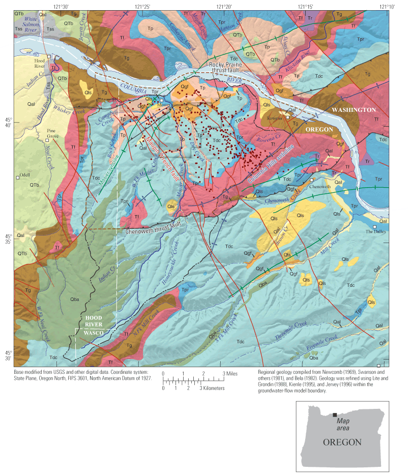 
Figure 2. Geology, structural features, and locations of wells used to construct the three-dimensional hydrogeologic framework model of the aquifer system underlying the Mosier, Oregon, study area. The extents of the groundwater-flow model and the watershed precipitation-recharge model also are shown. GIS data are available at http://pubs.usgs.gov/sir/2012/5002/. |
First posted March 1, 2012
For additional information contact: Part or all of this report is presented in Portable Document Format (PDF); the latest version of Adobe Reader or similar software is required to view it. Download the latest version of Adobe Reader, free of charge. |

![]() U.S. Department of the Interior |
U.S. Geological Survey
U.S. Department of the Interior |
U.S. Geological Survey
URL: http://pubsdata.usgs.gov/pubs/sir/2012/5002/figure2.html
Page Contact Information: GS Pubs Web Contact
Page Last Modified: Thursday, 10-Jan-2013 19:48:10 EST
