Scientific Investigations Report 2012–5017

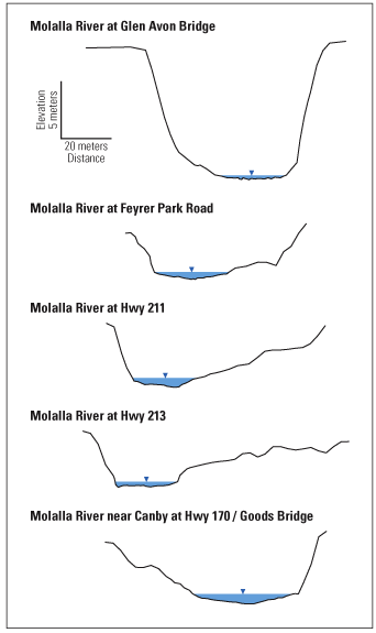
Figure 13. Comparison of measured geometry of five river cross sections surveyed on the Molalla River, Oregon. (The viewer’s perspective is looking downstream and the horizontal blue line represents the water-surface elevation on the day of the survey. The vertical exaggeration is 4.6x.) |
First posted February 29, 2012 For additional information contact: Part or all of this report is presented in Portable Document Format (PDF); the latest version of Adobe Reader or similar software is required to view it. Download the latest version of Adobe Reader, free of charge. |