Scientific Investigations Report 2012–5017
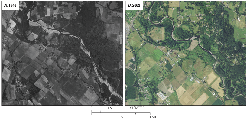
Figure 23. Aerial imagery of the Molalla River, Oregon, in geomorphic reach 4 (GR4) just upstream of Highway 213 bridge (FPkm 19.5) to about FPkm 23 in (A) 1948 and (B) 2009. (Some hydrologic high-flow event, a pulse of sediment and aggradation, or a combination of both led to a wide active channel and expansive gravel bars in 1948; subsequent revegetation decreased the active-channel width and increased sinuosity by 2009.) |
First posted February 29, 2012 For additional information contact: Part or all of this report is presented in Portable Document Format (PDF); the latest version of Adobe Reader or similar software is required to view it. Download the latest version of Adobe Reader, free of charge. |

![]() U.S. Department of the Interior |
U.S. Geological Survey
U.S. Department of the Interior |
U.S. Geological Survey
URL: http://pubsdata.usgs.gov/pubs/sir/2012/5017/figure23.html
Page Contact Information: GS Pubs Web Contact
Page Last Modified: Thursday, 10-Jan-2013 19:47:48 EST
