Scientific Investigations Report 2012–5017

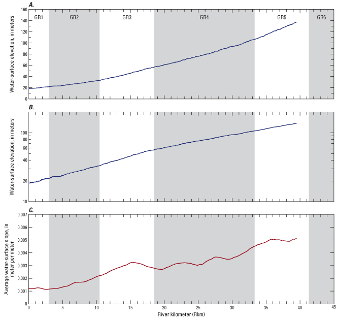
Figure 9. Light Detection and Ranging (LiDAR)-derived longitudinal water-surface elevation profile of the Molalla River, Oregon, with elevation plotted in (A) normal coordinates and (B) semi-log coordinates. (C) The slope of the water-surface elevation is also shown as a function of the river centerline. |
First posted February 29, 2012 For additional information contact: Part or all of this report is presented in Portable Document Format (PDF); the latest version of Adobe Reader or similar software is required to view it. Download the latest version of Adobe Reader, free of charge. |