 Abstract
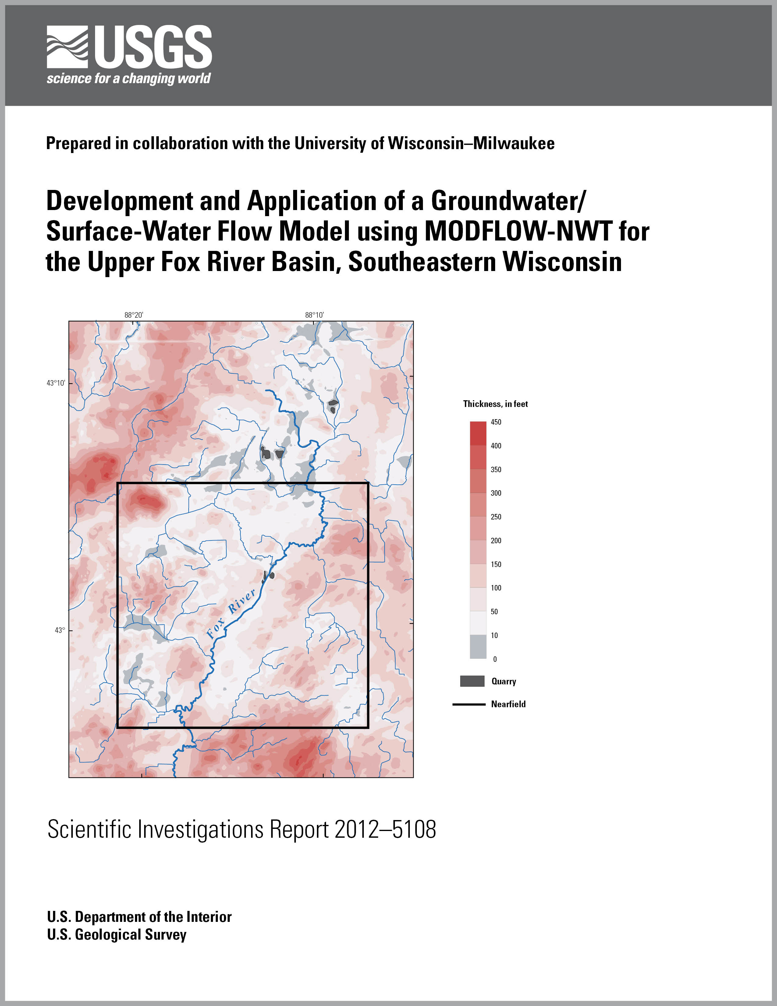
The Fox River is a 199-mile-long tributary to the Illinois River within the Mississippi River Basin in the states of Wisconsin and Illinois. For the purposes of this study the Upper Fox River Basin is defined as the topographic basin that extends from the upstream boundary of the Fox River Basin to a large wetland complex in south-central Waukesha County called the Vernon Marsh. The objectives for the study are to (1) develop a baseline study of groundwater conditions and groundwater/surface-water interactions in the shallow aquifer system of the Upper Fox River Basin, (2) develop a tool for evaluating possible alternative water-supply options for communities in Waukesha County, and (3) contribute to the methodology of groundwater-flow modeling by applying the recently published U.S. Geological Survey MODFLOW-NWT computer code, (a Newton formulation of MODFLOW-2005 intended for solving difficulties involving drying and rewetting nonlinearities of the unconfined groundwater-flow equation) to overcome computational problems connected with fine-scaled simulation of shallow aquifer systems by means of thin model layers.
To simulate groundwater conditions, a MODFLOW grid is constructed with thin layers and small cell dimensions (125 feet per side). This nonlinear unconfined problem incorporates the streamflow/lake (SFR/LAK) packages to represent groundwater/surface-water interactions, which yields an unstable solution sensitive to initial conditions when solved using the Picard-based preconditioned-gradient (PCG2) solver. A particular problem is the presence of many isolated wet water-table cells over dry cells, causing the simulated water table to assume unrealistically high values. Attempts to work around the problem by converting to confined conditions or converting active to inactive cells introduce unacceptable bias. Application of MODFLOW-NWT overcomes numerical problem by smoothing the transition from wet to dry cells and keeps all cells active. The simulation is insensitive to initial conditions and the water-table trend is smooth across layers. The MODFLOW-NWT code permits rigorous calibration and also robust application of the model to transient scenarios. Runtimes on a 64-bit computer are kept reasonably short by use of updated initial conditions and informed choices of solver parameters.
The shallow aquifer system consists of unconsolidated material of varying thickness over Silurian dolomite. The unconsolidated material, largely of glacial origin, contains fine-textured and coarse-textured deposits that vary in permeability over short distances. This study at least partly encompasses the inevitable uncertainty in the hydraulic conductivity zones by developing two models—one favors the continuity of fine-grained deposits and a second favors the continuity of coarse-grained deposits. The separate calibration processes for the fine-favored and coarse-favored models using MODFLOW-NWT and the nonlinear regression algorithms in the parameter estimation (PEST) code produce distinct parameter values for hydraulic conductivity zones, storage parameters, and streambed conductance zones.
Both models are applied to a hypothetical scenario involving 27 “riparian” wells completed adjacent to the river channel and open to the shallow aquifer systems along a 10-mile stretch of the Fox River. The results suggest that a riparian well system withdrawing about 9 million gallons per day would induce about one-third to one-half its total discharge from the river, and that this riverbank inducement would appreciably limit drawdown around the hypothetical wells.
|
Part or all of this report is presented in Portable Document Format (PDF); the latest version of Adobe Reader or similar software is required to view it. Download the latest version of Adobe Reader, free of charge. |

