Scientific Investigations Report 2012–5231

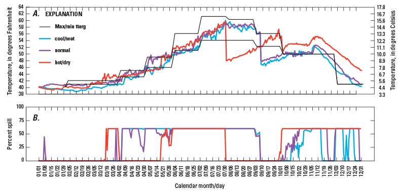
Figure 8. (A) Modeled water temperature and (B) percent spill for existing structural scenarios with base operational scenarios, and max temperature targets (scenarios c1, n1, h1), North Santiam River, Oregon. Percent spill is the percentage of total flow directed to outlets other than the power penstocks. The maximum and minimum temperature target established for the McKenzie River (labeled “Max/min ttarg”) is shown but only the maximum was used in this simulation. |
First posted October 30, 2012 For additional information contact: Part or all of this report is presented in Portable Document Format (PDF); the latest version of Adobe Reader or similar software is required to view it. Download the latest version of Adobe Reader, free of charge. |