Scientific Investigations Report 2012–5261
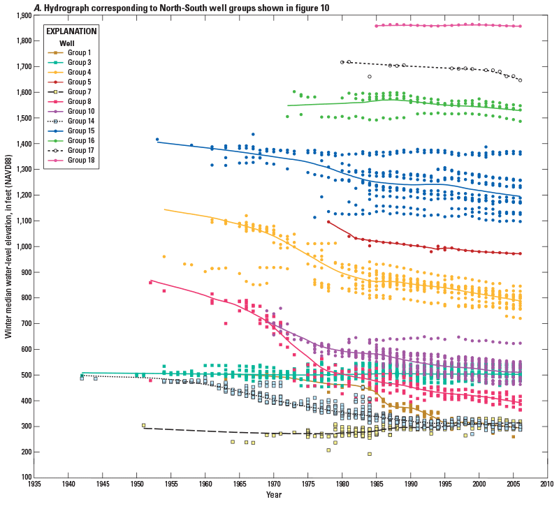 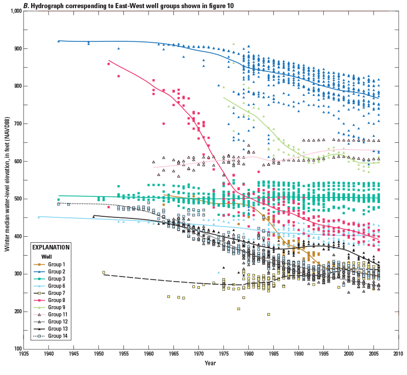
Figure 11. Groups of wells near the Oregon Water Resources Department administrative areas in the Umatilla Basin, Oregon. (A) North–South group (circles and squares); and (B) East–West group (triangles and squares). Hydrographs depict the winter median water level for individual wells within each well group and LOESS curve representing the overall water-level trend of all wells in the group. Locations of wells are shown in figure 10. |
First posted February 5, 2013 For additional information contact: Part or all of this report is presented in Portable Document Format (PDF); the latest version of Adobe Reader or similar software is required to view it. Download the latest version of Adobe Reader, free of charge. |

![]() U.S. Department of the Interior |
U.S. Geological Survey
U.S. Department of the Interior |
U.S. Geological Survey
URL: http://pubsdata.usgs.gov/pubs/sir/2012/5261/figure11.html
Page Contact Information: GS Pubs Web Contact
Page Last Modified: Thursday, 17-Jan-2013 15:32:54 EST
