Scientific Investigations Report 2012–5261
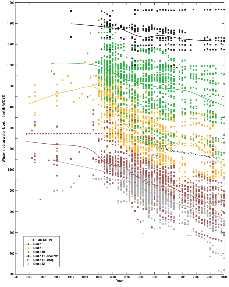
Figure 17. Groups of wells corresponding to the eastern flow path near the Washington State Department of Ecology administrative areas in parts of the Palouse Slope/eastern Yakima Fold Belt and the Columbia Basin Ground Water Management Area, Washington. Hydrographs depict the winter median water levels for individual wells within each well group and the trend line representing the overall water-level trend of all wells in the group. Well locations and flow paths are shown in figure 15. |
First posted February 5, 2013 For additional information contact: Part or all of this report is presented in Portable Document Format (PDF); the latest version of Adobe Reader or similar software is required to view it. Download the latest version of Adobe Reader, free of charge. |

![]() U.S. Department of the Interior |
U.S. Geological Survey
U.S. Department of the Interior |
U.S. Geological Survey
URL: http://pubsdata.usgs.gov/pubs/sir/2012/5261/figure17.html
Page Contact Information: GS Pubs Web Contact
Page Last Modified: Thursday, 17-Jan-2013 15:30:29 EST
