 Abstract
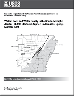
The U.S. Geological Survey in cooperation with the Arkansas Natural Resources Commission and the Arkansas Geological Survey has monitored water levels in the Sparta Sand of Claiborne Group and Memphis Sand of Claiborne Group (herein referred to as the Sparta Sand and the Memphis Sand, respectively) since the 1920s. Groundwater withdrawals have increased while water levels have declined since monitoring was initiated. Herein, aquifers in the Sparta Sand and Memphis Sand will be referred to as the Sparta-Memphis aquifer throughout Arkansas. During the spring of 2009, 324 water levels were measured in wells completed in the Sparta-Memphis aquifer and used to produce a regional potentiometric-surface map. During the summer of 2009, 64 water-quality samples were collected and measured for specific conductance, temperature, and pH from wells completed in the Sparta-Memphis aquifer.
The regional direction of groundwater flow in the
Sparta-Memphis aquifer is generally to the south-southeast
in the northern half of Arkansas and to the east and south
in the southern half of Arkansas, away from the outcrop
area except where affected by large groundwater withdrawals. The highest and lowest water-level altitudes measured in
the Sparta-Memphis aquifer were 325 feet above and 157
feet below National Geodetic Vertical Datum of 1929, respectively.
Eight depressions (generally represented by closed contours) are located in the following counties: Bradley; Ashley; Calhoun; Cleveland; Columbia; Arkansas, Jefferson, Lincoln, and Prairie; Cross and Poinsett; and Union. Two
large depressions shown on the 2009 potentiometric-surface map, centered in Jefferson and Union Counties, are the
result of large withdrawals for industrial, irrigation, or
public supply. The depression centered in Jefferson County deepened and expanded in recent years into Arkansas and Prairie Counties. The area enclosed within the 40-foot contour
on the 2009 potentiometric-surface map has expanded
south to the Drew County line and moved west from the intersection of Arkansas, Jefferson, and Lincoln Counties when compared with the 2007 potentiometric-surface map. To the north, east, and west, the 40-foot contour is comparable to the 2007 potentiometric-surface map. The lowest water-level altitude measurement during 2009 in
the center of the depression in Union County represents a
rise of 42 feet since 2003. The area enclosed by the lowest altitude contour, 140 feet below National Geodetic Vertical Datum of 1929, on the 2009 potentiometric-surface map is about half the area on the 2007 potentiometric-surface map.
In the depression in western Poinsett and Cross Counties, the 140-foot contour extended north to the Poinsett-Craighead County line and south across Cross County about two-thirds of the distance to the St. Francis County line.
A water-level difference map was constructed using water-level measurements made during 2005 and 2009 from 309 wells. The difference in water level between 2005 and 2009 ranged from -74.6 to 60.2 feet. Areas with a general rise in water levels occur in central Columbia County, southern Jefferson County, and most of Union County. In the area around west-central Union County, water levels rose as much as 60.2 feet with water levels in 18 wells rising 20 feet or more, representing an average annual rise of 5 feet or more. Water levels generally declined throughout most of the rest of Arkansas.
Hydrographs were constructed using a minimum of 25 years of water-level measurements at each of 206 wells. During the period 1985–2009, mean annual water levels
rose in Calhoun, Columbia, Lafayette, and Union Counties, about 1.3 feet per year (ft/yr), 0.2 ft/yr, 0.1 ft/yr, and
0.6 ft/yr, respectively. Mean annual water-level declines between 0.0 and 2.3 ft/yr occurred in all other counties. In western Arkansas County, water-level altitudes in a continuously monitored well declined 60 feet during the irrigation season (April to September).
Specific conductance ranged from 43 microsiemens per centimeter at 25 degrees Celsius (μS/cm) in Ouachita County to 1,230 μS/cm in Phillips County. The mean specific conductance was 392 μS/cm. Although there is a regional increase in specific conductance to the east and south, specific conductance values greater than 700 μS/cm occurred in samples from wells in Arkansas, Ashley, Monroe, Phillips, and Union Counties.

