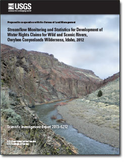
 Abstract Abstract
The U.S. Geological Survey, in cooperation with the Bureau of Land Management (BLM), collected streamflow data in 2012 and estimated streamflow statistics for stream segments designated "Wild," "Scenic," or "Recreational" under the National Wild and Scenic Rivers System in the Owyhee Canyonlands Wilderness in southwestern Idaho. The streamflow statistics were used by BLM to develop and file a draft, federal reserved water right claim in autumn 2012 to protect federally designated "outstanding remarkable values" in the stream segments. BLM determined that the daily mean streamflow equaled or exceeded 20 and 80 percent of the time during bimonthly periods (two periods per month) and the bankfull streamflow are important streamflow thresholds for maintaining outstanding remarkable values. Prior to this study, streamflow statistics estimated using available datasets and tools for the Owyhee Canyonlands Wilderness were inaccurate for use in the water rights claim.
Streamflow measurements were made at varying intervals during February–September 2012 at 14 monitoring sites; 2 of the monitoring sites were equipped with telemetered streamgaging equipment. Synthetic streamflow records were created for 11 of the 14 monitoring sites using a partial‑record method or a drainage-area-ratio method. Streamflow records were obtained directly from an operating, long-term streamgage at one monitoring site, and from discontinued streamgages at two monitoring sites. For 10 sites analyzed using the partial-record method, discrete measurements were related to daily mean streamflow at a nearby, telemetered “index” streamgage. Resulting regression equations were used to estimate daily mean and annual peak streamflow at the monitoring sites during the full period of record for the index sites. A synthetic streamflow record for Sheep Creek was developed using a drainage-area-ratio method, because measured streamflows did not relate well to any index site to allow use of the partial-record method. The synthetic and actual daily mean streamflow records were used to estimate daily mean streamflow that was exceeded 80, 50, and 20 percent of the time (80-, 50-, and 20-percent exceedances) for bimonthly and annual periods. Bankfull streamflow statistics were calculated by fitting the synthetic and actual annual peak streamflow records to a log Pearson Type III distribution using Bulletin 17B guidelines in the U.S. Geological Survey PeakFQ program.
The coefficients of determination (R2) for the regressions between the monitoring and index sites ranged from 0.74 for Wickahoney Creek to 0.98 for the West Fork Bruneau River and Deep Creek. Confidence in computed streamflow statistics is highest among other sites for the East Fork Owyhee River and the West Fork Bruneau River on the basis of regression statistics, visual fit of the related data, and the range and number of streamflow measurements. Streamflow statistics for sites with the greatest uncertainty included Big Jacks, Little Jacks, Cottonwood, Wickahoney, and Sheep Creeks. The uncertainty in computed streamflow statistics was due to a number of factors which included the distance of index sites relative to monitoring sites, relatively low streamflow conditions that occurred during the study, and the limited number and range of streamflow measurements. However, the computed streamflow statistics are considered the best possible estimates given available datasets in the remote study area. Streamflow measurements over a wider range of hydrologic and climatic conditions would improve the relations between streamflow characteristics at monitoring and index sites. Additionally, field surveys are needed to verify if the streamflows selected for the water rights claims are sufficient for maintaining outstanding remarkable values in the Wild and Scenic rivers included in the study.
|
First posted December 4, 2013
Part or all of this report is presented in Portable Document Format (PDF). For best results viewing and printing PDF documents, it is recommended that you download the documents to your computer and open them with Adobe Reader. PDF documents opened from your browser may not display or print as intended. Download the latest version of Adobe Reader, free of charge.
|

