 Abstract Abstract
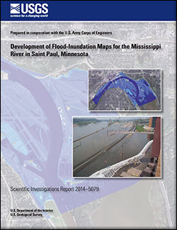
Digital flood-inundation maps for a 6.3-mile reach of the Mississippi River in Saint Paul, Minnesota, were developed through a multi-agency effort by the U.S. Geological Survey in cooperation with the U.S. Army Corps of Engineers and in collaboration with the National Weather Service. The inundation maps, which can be accessed through the U.S. Geological Survey Flood Inundation Mapping Science Web site at http://water.usgs.gov/osw/flood_inundation/ and the National Weather Service Advanced Hydrologic Prediction Service site at http://water.weather.gov/ahps/inundation.php, depict estimates of the areal extent and depth of flooding corresponding to selected water levels (stages) at the U.S. Geological Survey streamgage at the Mississippi River at Saint Paul (05331000). The National Weather Service forecasted peak-stage information at the streamgage may be used in conjunction with the maps developed in this study to show predicted areas of flood inundation.
In this study, flood profiles were computed for the Mississippi River by means of a one-dimensional step-backwater model. The hydraulic model was calibrated using the most recent stage-discharge relation at the Robert Street location (rating curve number 38.0) of the Mississippi River at Saint Paul (streamgage 05331000), as well as an approximate water-surface elevation-discharge relation at the Mississippi River at South Saint Paul (U.S. Army Corps of Engineers streamgage SSPM5). The model also was verified against observed high-water marks from the recent 2011 flood event and the water-surface profile from existing flood insurance studies. The hydraulic model was then used to determine 25 water-surface profiles for flood stages at 1-foot intervals ranging from approximately bankfull stage to greater than the highest recorded stage at streamgage 05331000. The simulated water-surface profiles were then combined with a geographic information system digital elevation model, derived from high-resolution topography data, to delineate potential areas flooded and to determine the water depths within the inundated areas for each stage at streamgage 05331000.
The availability of these maps along with information regarding current stage at the U.S. Geological Survey streamgage and forecasted stages from the National Weather Service provides enhanced flood warning and visualization of the potential effects of a forecasted flood for the city of Saint Paul and its residents. The maps also can aid in emergency management planning and response activities, such as evacuations and road closures, as well as for post-flood recovery efforts.
|
First posted May 23, 2014
Part or all of this report is presented in Portable Document Format (PDF). For best results viewing and printing PDF documents, it is recommended that you download the documents to your computer and open them with Adobe Reader. PDF documents opened from your browser may not display or print as intended. Download the latest version of Adobe Reader, free of charge.
|

