The purpose of these interpretive discussions is to provide a perspective on regional- and national-scale variations in element and mineral distributions in soils and their likely causes. The significant spatial variations shown by most elements and minerals can commonly be attributed to geologic sources in underlying parent materials, but other spatial variations seem clearly related to additional factors such as climate, the age of soils, transported source material, and anthropogenic influences. We attempt to distinguish the influence of these various factors on a regional and national scale. Numerous more local features might similarly be related to these same factors, but these features also have some probability of being an artifact of a random sampling of variable compositions, so that there is some probability of samples with similar compositions occurring in clusters of two or more adjacent sites by chance. Distinguishing such random occurrences from true variability is beyond the scope of the data from which these maps are constructed. Some caution, therefore, is advisable in interpreting the significance of these more local features unless some unique sources or processes can clearly be related to them.
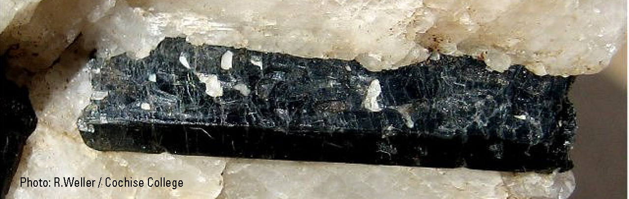
Hornblende ((Ca,Na)2-3(Mg,Fe,Al)5(Al,Si)8O22(OH,F)2) is a chemically complex mineral in which solid solution of numerous elements results in widely variable composition. It is a member of the amphibole group of minerals. We have used a crystal structure of hornblende in quantitative calculations, but other related amphibole minerals might be included in addition to hornblende. Hornblende forms under high temperatures and occurs in a variety of igneous and metamorphic rocks. It is relatively stable in many weathering regimes, so it can also occur as clastic grains in sedimentary rocks.
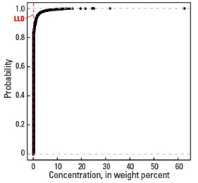
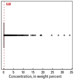
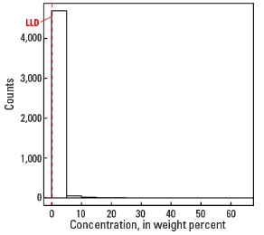
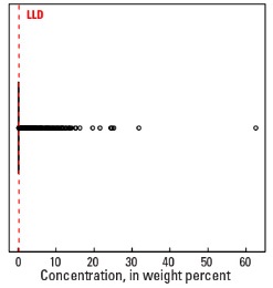
Hornblende is not present in most samples and its median concentration is less than the detection limit of 0.2 weight percent (wt. %) for both the soil A and C horizons. But 5 percent of samples contain more than 1.8 wt. % hornblende in the soil C horizon and 1.6 wt. % in the soil A horizon (see the summary statistics [open in new window]).
The distribution of hornblende across the conterminous United States strongly mimics the occurrence of igneous and metamorphic rocks. It is not detectable in many large areas, such as the central United States, where there are few occurrences of hornblende–bearing bedrock. The greatest abundance lies in a belt in California that is underlain by granitic rocks of the Sierra Nevada Mountains (USDA, 2006) and an area in northern California and southern Oregon where bedrock is a complex assemblage of sedimentary, volcanic, and igneous rocks. Hornblende is also widespread in soils of Washington and parts of northern Idaho. In these areas, bedrock contains igneous and metamorphic rocks of the Columbia Plateau (Fenneman and Johnson, 1946), Cascade Range, and Northern Rocky Mountains (USDA, 2006).
A second large area of hornblende–bearing soils is in the Upper Midwest in parts of Minnesota, Wisconsin, and Michigan. The bedrock source is Precambrian crystalline rocks, but hornblende has been disbursed by Pleistocene glacial transport beyond the outcrop area of the Precambrian bedrock. The sharp western and southern boundaries of this area correspond to the outer limits of the Wadena, Rainy, and Superior lobes of glaciation (Grimley, 2000) more closely than to the bedrock patterns. Parts of the northeastern United States also have hornblende–bearing soils in areas of crystalline bedrock, especially in the Adirondack highlands (Fenneman and Johnson, 1946), New York. A smaller area of high concentrations of hornblende is in the Piedmont and Blue Ridge Provinces (Fenneman and Johnson, 1946) of North Carolina, South Carolina, and Tennessee where mafic metamorphic rocks are common in the bedrock.
Statistics - 0 TO 5 CM
Statistics - A Horizon
| Number of samples | 4,802 |
| LLD | 0.2 wt. % |
| Number below LLD | 4,034 |
| Minimum | <0.2 wt. % |
| 5 percentile | <0.2 wt. % |
| 25 percentile | <0.2 wt. % |
| 50 percentile | <0.2 wt. % |
| 75 percentile | <0.2 wt. % |
| 95 percentile | 1.6 wt. % |
| Maximum | 33.8 wt. % |
| MAD | |
| Robust CV |
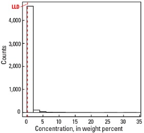
Histogram
Boxplot

Empirical cumulative distribution function
Statistics - C Horizon
| Number of samples | 4,773 |
| LLD | 0.2 wt. % |
| Number below LLD | 3,933 |
| Minimum | <0.2 wt. % |
| 5 percentile | <0.2 wt. % |
| 25 percentile | <0.2 wt. % |
| 50 percentile | <0.2 wt. % |
| 75 percentile | <0.2 wt. % |
| 95 percentile | 1.8 wt. % |
| Maximum | 62.6 wt. % |
| MAD | |
| Robust CV |
Histogram
Boxplot